Map of Ireland
Ireland is a country in northwestern Europe that covers most of the island of Ireland. Its only land border is with Northern Ireland, part of the United Kingdom, and it is surrounded by the Atlantic Ocean, the Celtic Sea and the Irish Sea, which separates it from Great Britain. The political map shows its regions, the capital, Dublin, and major cities.

- Capital
- Dublin
- Population
- 5.1 million (2022)
- Area
- 69,797 km² (26,949 sq mi)
- Population density
- 74 per km² (191 per sq mi)
- Official languages
- Irish and English
- Currency
- euro
- Demonym
- Irish
- Highest point
- Carrauntoohil (1,039 m (3,409 ft))
- Calling code
- +353
- Internet domain
- .ie
Where is Ireland?
Ireland is a country in northwestern Europe that covers most of the island of Ireland. Its only land border is with Northern Ireland, part of the United Kingdom, and it is surrounded by the Atlantic Ocean, the Celtic Sea and the Irish Sea, which separates it from Great Britain.
Neighboring countries: United Kingdom.

Regions of Ireland and their capitals
Ireland's local government is based on counties and city councils such as Dublin, Cork and Galway, and the counties belong to the historic provinces of Leinster, Munster, Connacht and part of Ulster. The divisions on the map come from Natural Earth and may not reflect the latest local government reform.
The divisions on the map come from Natural Earth and may not reflect the latest territorial reform in Ireland.
| Region | Capital | Population | Area |
|---|---|---|---|
| Carlow | Carlow | 56,875 | 897 km² (346 sq mi) |
| Cavan | Cavan | 73,183 | 1,932 km² (746 sq mi) |
| Clare | Ennis | 117,096 | 3,450 km² (1,332 sq mi) |
| Cork | Cork | 542,196 | 7,500 km² (2,896 sq mi) |
| Cork City | Cork | 542,196 | 7,500 km² (2,896 sq mi) |
| Donegal | Lifford | 161,137 | 4,861 km² (1,877 sq mi) |
| Dublin | Dublin | 1,270,603 | 922 km² (356 sq mi) |
| Dún Laoghaire–Rathdown | — | — | — |
| Fingal | Swords | 296,214 | 455 km² (176 sq mi) |
| Galway | Galway | 277,737 | 6,149 km² (2,374 sq mi) |
| Galway City | Galway | 277,737 | 6,149 km² (2,374 sq mi) |
| Kerry | Tralee | 147,707 | 4,807 km² (1,856 sq mi) |
| Kildare | Naas | 222,130 | 1,693 km² (654 sq mi) |
| Kilkenny | Kilkenny | 99,232 | 2,073 km² (800 sq mi) |
| Laois | Port Laoise | 67,012 | 1,720 km² (664 sq mi) |
| Leitrim | Carrick-on-Shannon | 35,199 | 1,590 km² (614 sq mi) |
| Limerick | Limerick | 195,175 | 2,756 km² (1,064 sq mi) |
| Limerick City | Limerick | 195,175 | 2,756 km² (1,064 sq mi) |
| Longford | Longford | 40,873 | 1,091 km² (421 sq mi) |
| Louth | Dundalk | 128,375 | 826 km² (319 sq mi) |
| Mayo | Castlebar | 130,638 | 5,586 km² (2,157 sq mi) |
| Meath | Navan | 194,942 | 2,342 km² (904 sq mi) |
| Monaghan | Monaghan | 60,483 | 1,295 km² (500 sq mi) |
| North Tipperary | Clonmel | 158,652 | 4,305 km² (1,662 sq mi) |
| Offaly | Tullamore | 78,003 | 2,001 km² (773 sq mi) |
| Roscommon | Roscommon | 64,436 | 2,548 km² (984 sq mi) |
| Sligo | Sligo | 65,393 | 1,838 km² (710 sq mi) |
| South Dublin | South Dublin | — | — |
| South Tipperary | Clonmel | 158,652 | 4,305 km² (1,662 sq mi) |
| Waterford | Waterford | 113,795 | 1,857 km² (717 sq mi) |
| Waterford City | Waterford | 113,795 | 1,857 km² (717 sq mi) |
| Westmeath | Mullingar | 88,396 | 1,840 km² (710 sq mi) |
| Wexford | Wexford | 145,273 | 2,365 km² (913 sq mi) |
| Wicklow | Wicklow | 142,332 | 2,027 km² (783 sq mi) |
Population from Wikidata (latest figure available for each region).
Blank and coloring maps of Ireland
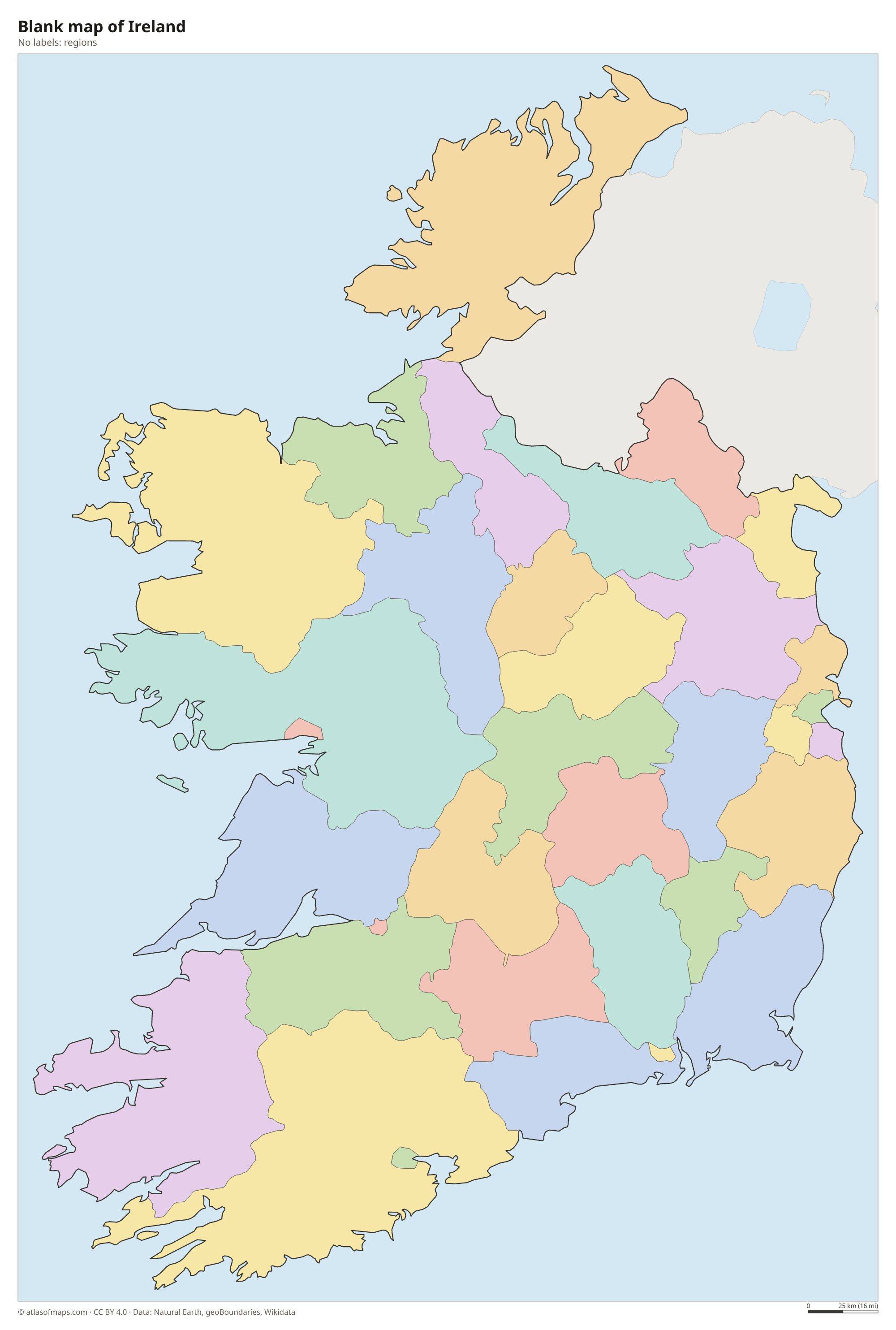
Blank map of Ireland

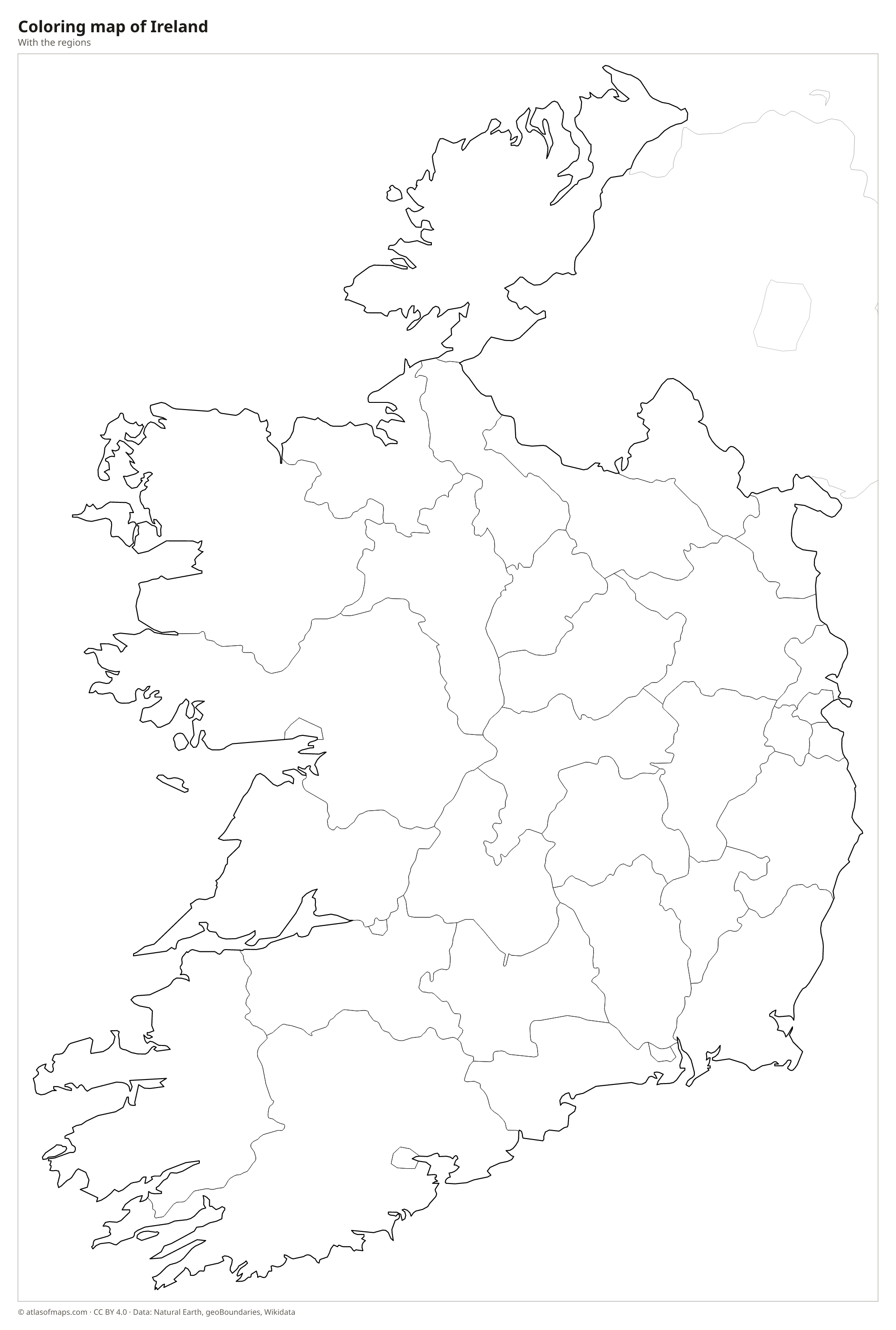
Coloring map of Ireland

Geography of Ireland
Ireland covers 69,797 km² (26,949 sq mi) and is often compared to a saucer: a low central plain of farmland, lakes and peat bogs is ringed by hills and mountains near the coast. The highest range is MacGillycuddy's Reeks in County Kerry, where Carrauntoohil rises to 1,039 m (3,409 ft). Other uplands include the Wicklow Mountains south of Dublin and the rugged hills of Connemara. In County Clare, the Burren is a bare limestone landscape, and the Cliffs of Moher drop straight into the Atlantic.
The River Shannon, the longest river in Ireland, flows south through the center of the country, widening into lakes such as Lough Ree and Lough Derg before reaching the Atlantic near Limerick. Lough Corrib in the west is the largest lake in the state. The Atlantic coast is deeply indented, with peninsulas such as Dingle and bays such as Galway Bay, while the east coast is smoother. The climate is mild and wet, warmed by the North Atlantic Current, so winters rarely bring heavy snow and the countryside stays green all year.
Fun facts
- The River Shannon is the longest river in Ireland and in the whole of the British Isles.
- Skellig Michael, a steep rocky island off County Kerry with an early Christian monastery, is a UNESCO World Heritage Site.
- Ireland is nicknamed the Emerald Isle because its mild, rainy climate keeps the grass green all year.
Flag of Ireland
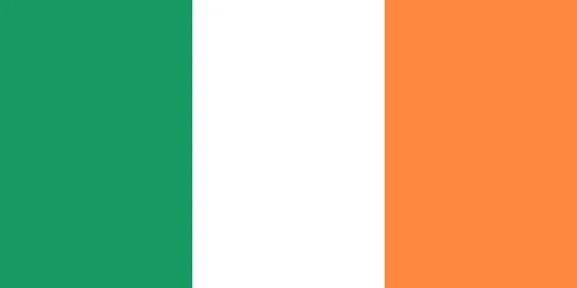
Ireland's flag is a vertical tricolor of three equal stripes: green next to the pole, white in the middle and orange on the far side. It has no emblem and a 1:2 ratio. It looks similar to the flag of Ivory Coast, which has the same colors in the opposite order and a shorter shape.
Countries bordering Ireland
Frequently asked questions
Is Ireland part of the United Kingdom?
No. Ireland is an independent country and a member of the European Union. Only Northern Ireland, in the northeast of the island, is part of the United Kingdom.
What countries border Ireland?
Ireland has one land neighbor, the United Kingdom, through the border with Northern Ireland. Across the Irish Sea lies Great Britain, which is also part of the United Kingdom.
What is the capital of Ireland?
The capital and largest city is Dublin, on the east coast, where the River Liffey flows into Dublin Bay on the Irish Sea.
What language is spoken in Ireland?
The official languages are Irish and English.
Can I print the map of Ireland?
Yes. Every map on this page can be downloaded for free as PNG or PDF (US Letter) and printed, including the blank map and the coloring map. Please credit the source (Atlas of Maps, CC BY 4.0).
Use this map
You can download, print and share this map for free, in class, in school projects, in presentations and on websites, as long as you credit the source: Map of Ireland · Atlas of Maps (atlasofmaps.com), license CC BY 4.0.
See also: Map of Europe · Map of the European Union · World map