Map of New Zealand with regions and capitals
New Zealand is an island country in the southwest Pacific Ocean, in Oceania. It lies southeast of Australia across the Tasman Sea and has no land borders; its two main islands are the North Island and the South Island. The political map shows its 16 regions, the Chatham Islands and other outlying islands, the capital, Wellington, and major cities.

- Capital
- Wellington
- Population
- 5.3 million (2024)
- Area
- 268,021 km² (103,483 sq mi)
- Population density
- 20 per km² (51 per sq mi)
- Official languages
- Māori and English
- Currency
- New Zealand dollar
- Demonym
- New Zealander
- Divisions
- 16 regions, the Chatham Islands and other outlying islands
- Highest point
- Aoraki / Mount Cook (3,724 m (12,218 ft))
- Calling code
- +64
- Internet domain
- .nz
Where is New Zealand?
New Zealand is an island country in the southwest Pacific Ocean, in Oceania. It lies southeast of Australia across the Tasman Sea and has no land borders; its two main islands are the North Island and the South Island.

Regions of New Zealand and their capitals
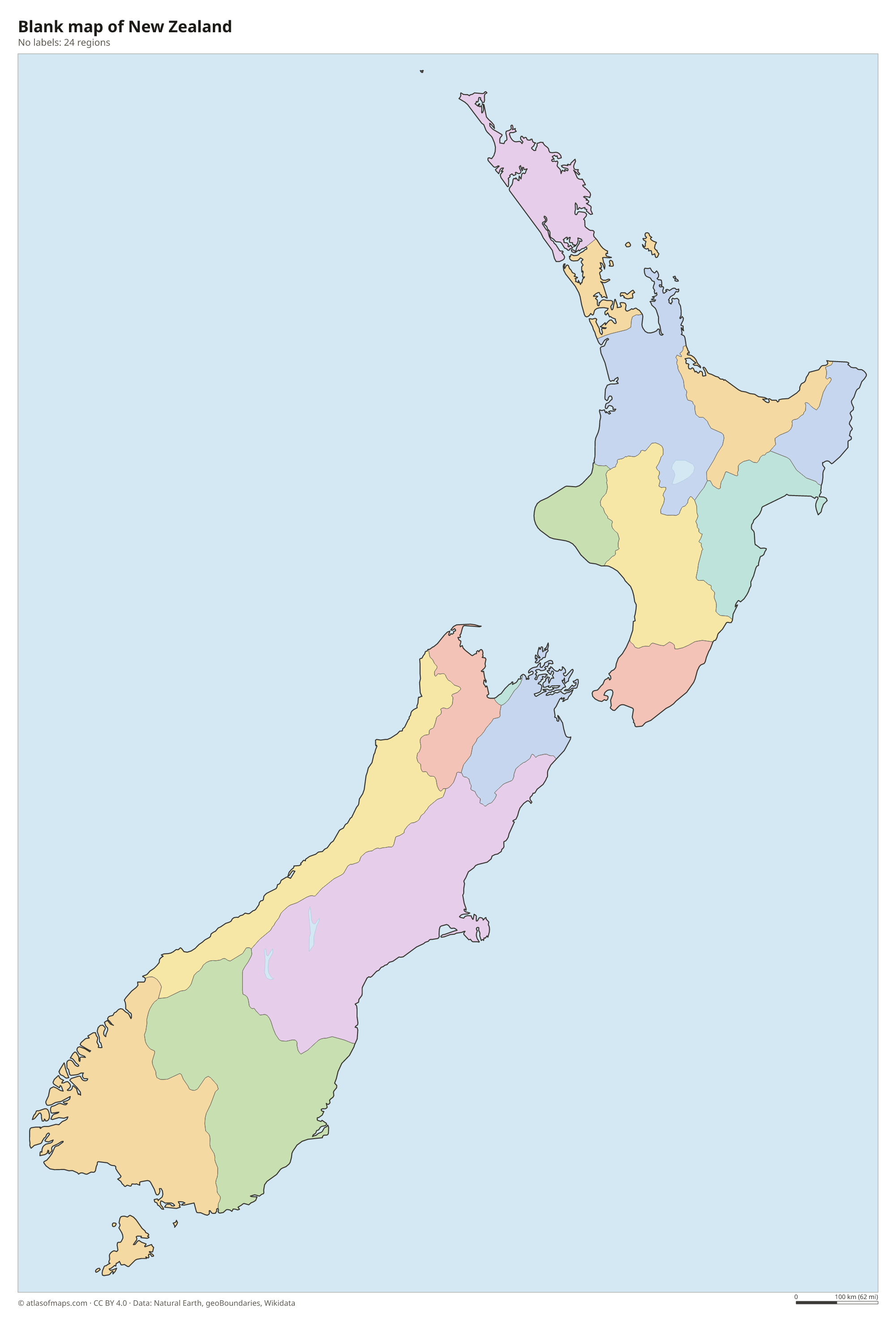
New Zealand is divided into 16 regions, such as Auckland, Canterbury and Otago, the units on the map. The Chatham Islands, east of the mainland, have their own council, and remote groups such as the Kermadec and subantarctic islands lie outside any region.
| Region | Capital | Population | Area |
|---|---|---|---|
| Antipodes Islands | — | — | — |
| Auckland | — | 1,816,000 | 4,894 km² (1,890 sq mi) |
| Auckland Islands | — | — | — |
| Bay of Plenty | Whakatāne | 351,500 | 12,231 km² (4,722 sq mi) |
| Campbell Islands | — | — | — |
| Canterbury | Christchurch | 698,200 | 44,504 km² (17,183 sq mi) |
| Chatham Islands | Waitangi | 730 | 966 km² (373 sq mi) |
| Gisborne | Gisborne | 52,700 | 8,385 km² (3,237 sq mi) |
| Hawke's Bay | Napier | 179,700 | 14,111 km² (5,448 sq mi) |
| Kermadec Islands | — | — | — |
| Manawatū-Whanganui | Palmerston North | 260,700 | 22,215 km² (8,577 sq mi) |
| Marlborough | Blenheim | 50,800 | 12,485 km² (4,820 sq mi) |
| Nelson | — | 51,100 | 445 km² (172 sq mi) |
| Northland | Whangārei | 201,100 | 13,789 km² (5,324 sq mi) |
| Otago | Dunedin | 253,900 | 31,241 km² (12,062 sq mi) |
| Snares Islands | — | — | — |
| Southland | Invercargill | 104,800 | 34,347 km² (13,261 sq mi) |
| Taranaki | Stratford | 130,300 | 7,257 km² (2,802 sq mi) |
| Tasman | Richmond | 59,900 | 9,771 km² (3,773 sq mi) |
| Three Kings Islands | — | — | — |
| Tokelau | — | — | — |
| Waikato | Hamilton | 532,100 | 25,598 km² (9,883 sq mi) |
| Wellington | Wellington | 543,400 | 8,140 km² (3,143 sq mi) |
| West Coast | Greymouth | 34,700 | 23,276 km² (8,987 sq mi) |
Population from Wikidata (latest figure available for each region).
Blank and coloring maps of New Zealand
Blank map of New Zealand

Coloring map of New Zealand

Geography of New Zealand
New Zealand covers 268,021 km² (103,483 sq mi). The South Island is dominated by the Southern Alps, which run almost its full length and hold glaciers and Aoraki / Mount Cook, the highest point at 3,724 m (12,218 ft). East of the mountains lie the Canterbury Plains, and in the southwest the fiords of Fiordland cut deep into the coast. The North Island is lower but more volcanic, with active cones such as Ruapehu and Tongariro on its central plateau.
Lake Taupō, in the crater of a huge ancient volcano, is the largest lake, and the Waikato River flows from it to the west coast as the country's longest river. Cook Strait separates the two main islands, and Stewart Island lies south of the South Island. New Zealand sits on the boundary of two tectonic plates, so earthquakes and geothermal activity are common, especially around Rotorua. The climate is mostly temperate: mild and wet in the west, drier in the east and subtropical in the far north.
Fun facts
- Wellington is the southernmost capital city of any sovereign country.
- A hill in Hawke's Bay has one of the longest place names in the world, a Māori name of 85 letters.
- No place in New Zealand is more than about 130 km (80 mi) from the sea.
Flag of New Zealand
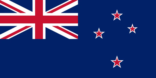
The flag of New Zealand is dark blue with the Union Jack of the United Kingdom in the upper hoist corner. On the fly side are four red five-pointed stars with white borders, arranged as the Southern Cross constellation. The flag has a 1:2 ratio.
Frequently asked questions
Is New Zealand part of Australia?
No. New Zealand is an independent country. It lies about 2,000 km (1,200 mi) southeast of Australia across the Tasman Sea, and both belong to the region of Oceania.
How many regions does New Zealand have?
New Zealand has 16 regions, from Northland in the north to Southland in the south. The Chatham Islands and other outlying islands are run outside this regional system.
What is the capital of New Zealand?
Wellington, at the southern tip of the North Island, is the capital. Auckland, in the north of the North Island, is the largest city.
What countries border New Zealand?
New Zealand has no land borders with other countries: all its borders are at sea.
What language is spoken in New Zealand?
The official languages are Māori and English.
Can I print the map of New Zealand?
Yes. Every map on this page can be downloaded for free as PNG or PDF (US Letter) and printed, including the blank map and the coloring map. Please credit the source (Atlas of Maps, CC BY 4.0).
Use this map
You can download, print and share this map for free, in class, in school projects, in presentations and on websites, as long as you credit the source: Map of New Zealand · Atlas of Maps (atlasofmaps.com), license CC BY 4.0.
See also: Map of Oceania · World map