Map of South Korea with provinces and capitals
South Korea is a country in East Asia that occupies the southern half of the Korean Peninsula. Its only land border is with North Korea; the Yellow Sea lies to the west, the Sea of Japan (East Sea) to the east and the Korea Strait to the south. The political map shows its 17 provinces, the capital, Seoul, and major cities.

- Capital
- Seoul
- Population
- 51.5 million (2017)
- Area
- 100,295 km² (38,724 sq mi)
- Population density
- 513 per km² (1,329 per sq mi)
- Official language
- Korean
- Currency
- won
- Demonym
- South Korean
- Provinces
- 17
- Highest point
- Hallasan (1,947 m (6,388 ft))
- Calling code
- +82
- Internet domain
- .kr
- Official name
- Republic of Korea
- Also known as
- Korea
Where is South Korea?
South Korea is a country in East Asia that occupies the southern half of the Korean Peninsula. Its only land border is with North Korea; the Yellow Sea lies to the west, the Sea of Japan (East Sea) to the east and the Korea Strait to the south.
Neighboring countries: North Korea.

Provinces of South Korea and their capitals
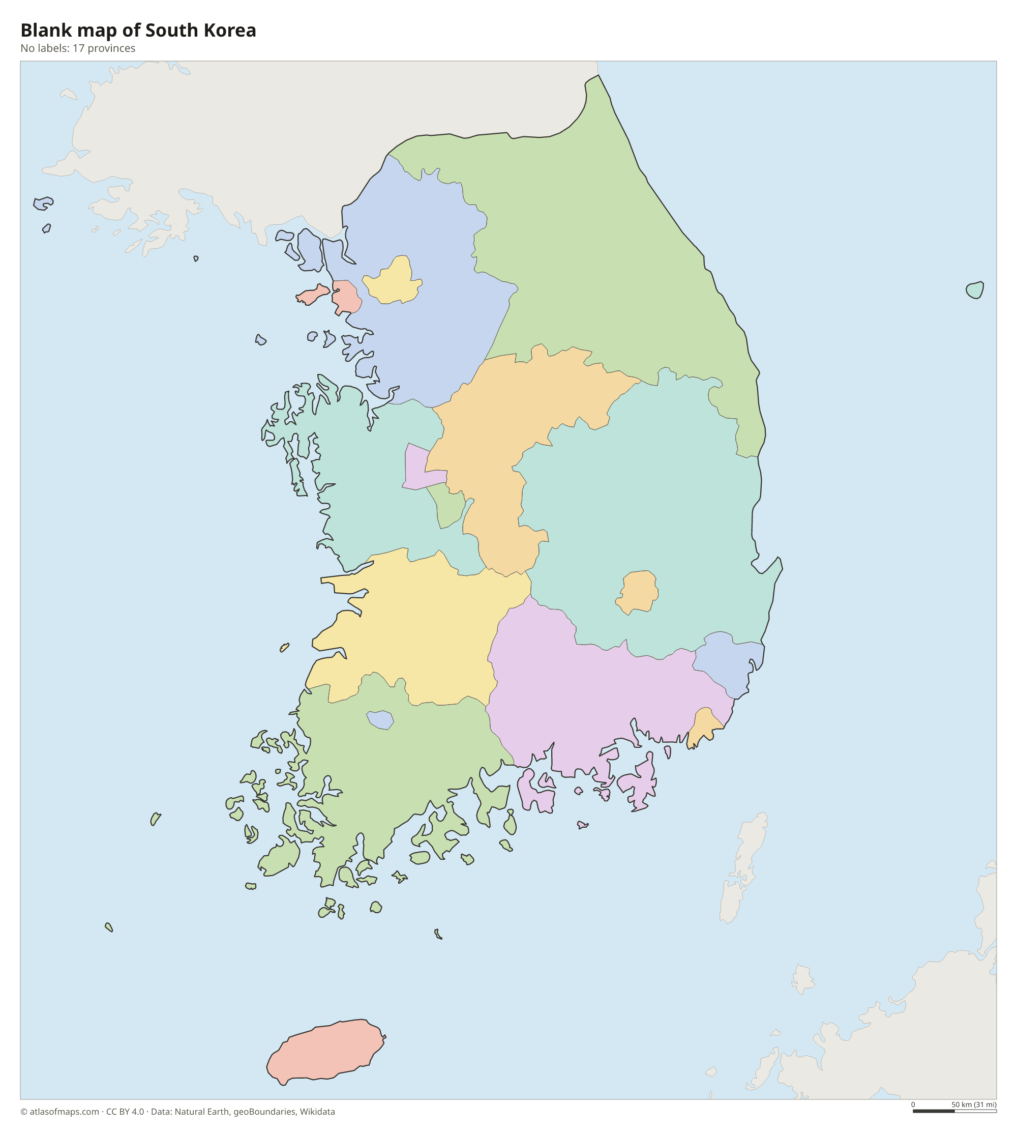
South Korea has 17 first-level divisions, shown on the map: the special city of Seoul, six metropolitan cities such as Busan and Incheon, the special self-governing city of Sejong, and nine provinces, including Jeju Special Self-Governing Province.
| Province | Capital | Population | Area |
|---|---|---|---|
| Busan | Yeonje District | 3,453,198 | 770 km² (297 sq mi) |
| Daegu | — | 2,376,044 | 1,500 km² (579 sq mi) |
| Daejeon | — | 1,475,221 | 540 km² (208 sq mi) |
| Gangwon | Chuncheon | 1,539,274 | 16,874 km² (6,515 sq mi) |
| Gwangju | — | 1,409,624 | 501 km² (193 sq mi) |
| Gyeonggi | Suwon | 13,103,188 | 10,172 km² (3,927 sq mi) |
| Incheon | — | 3,049,315 | 1,047 km² (404 sq mi) |
| Jeju | Jeju | 670,837 | 1,848 km² (714 sq mi) |
| North Chungcheong | Cheongju | 1,595,058 | 7,407 km² (2,860 sq mi) |
| North Gyeongsang | Andong | 2,546,960 | 19,029 km² (7,347 sq mi) |
| North Jeolla | Jeonju | 1,769,607 | 8,067 km² (3,115 sq mi) |
| Sejong | — | 391,984 | 465 km² (180 sq mi) |
| Seoul | Jung District | 9,668,465 | 605 km² (234 sq mi) |
| South Chungcheong | Hongseong County | 2,181,416 | 8,204 km² (3,168 sq mi) |
| South Gyeongsang | Changwon | 3,350,350 | 10,538 km² (4,069 sq mi) |
| South Jeolla | Muan County | 1,790,352 | 12,309 km² (4,753 sq mi) |
| Ulsan | — | 1,127,553 | 1,060 km² (409 sq mi) |
Population from Wikidata (latest figure available for each province).
Blank and coloring maps of South Korea
Blank map of South Korea

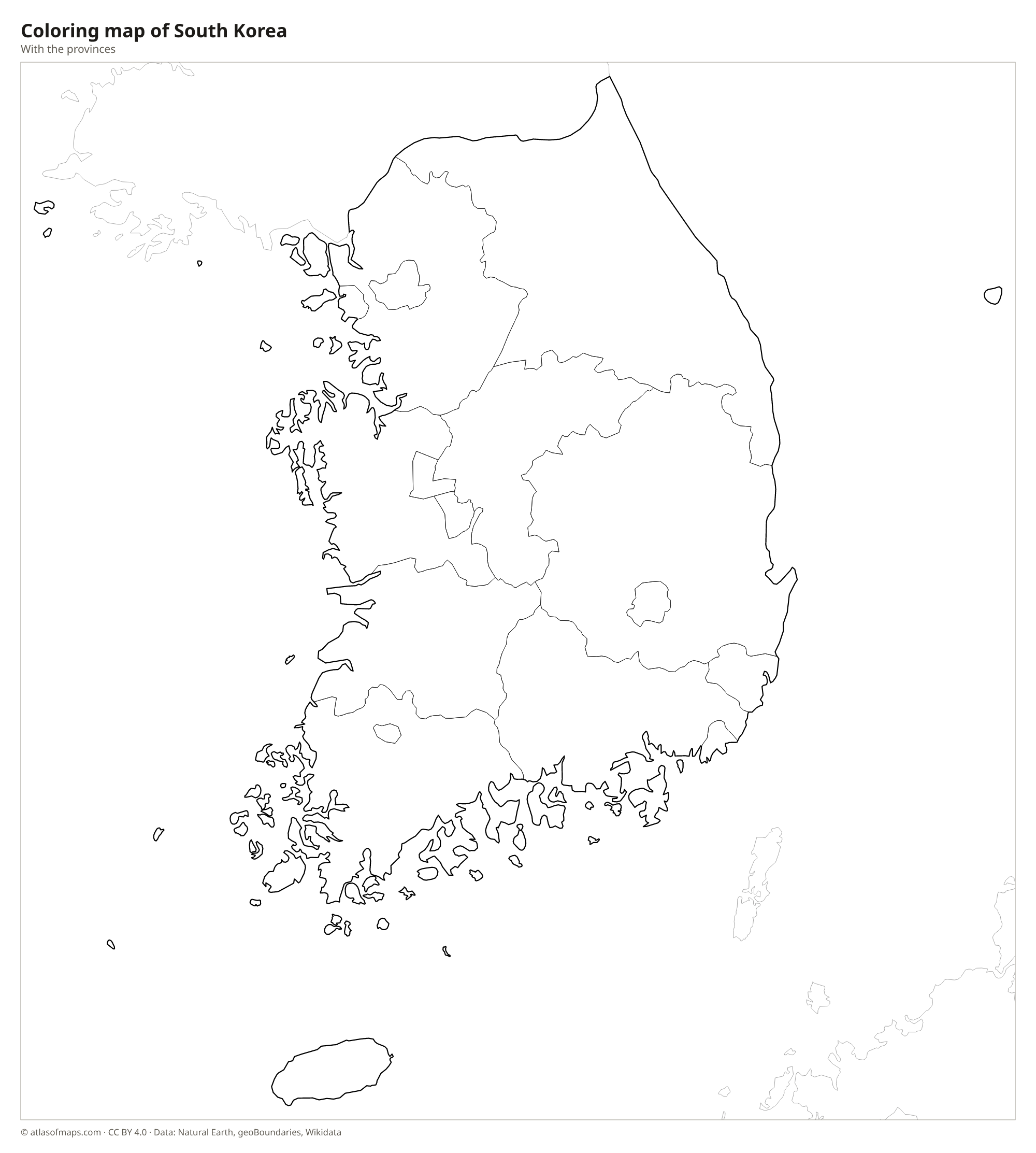
Coloring map of South Korea

Geography of South Korea
About 70 percent of South Korea is hilly or mountainous. The Taebaek Mountains run along the east coast like a backbone, so the land slopes from high ground in the east to plains and river valleys in the west, where most cities and farms are. The Sobaek Mountains branch off toward the southwest. The highest point is Hallasan, a volcano on Jeju Island off the south coast, at 1,947 m (6,388 ft). More than 3,000 islands lie offshore, most of them along the western and southern coasts.
The main rivers flow west or south: the Han River crosses Seoul to the Yellow Sea, while the Nakdong, the longest, flows south past Daegu to Busan. The west and south coasts are deeply indented, with wide tidal flats, bays and islands, while the east coast is straight with sandy beaches. The climate is temperate, with four distinct seasons: hot, humid summers brought by the monsoon and cold, dry winters. Typhoons sometimes reach the south in late summer. The Demilitarized Zone along the northern border has become a refuge for wildlife.
Fun facts
- Jeju Island, with Hallasan and its lava tubes, is a UNESCO World Heritage Site.
- The Demilitarized Zone between the two Koreas is about 4 km (2.5 mi) wide.
- About half of all South Koreans live in the Seoul Capital Area.
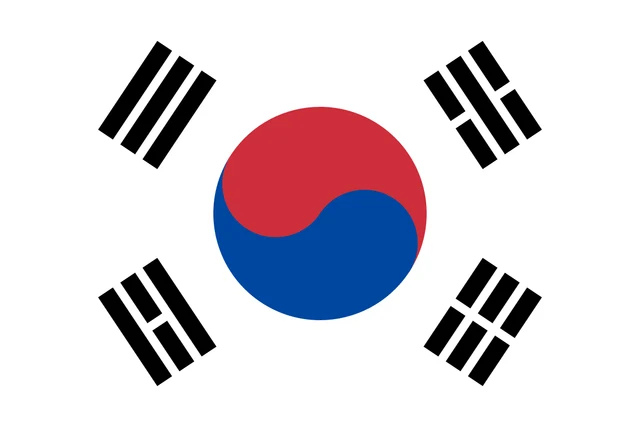
Flag of South Korea
The flag of South Korea, called Taegukgi, has a white field with a red and blue circle in the center, the taeguk, divided by an S-shaped curve with red on top and blue below. In the four corners around it are four black trigrams, each made of three solid or broken bars.
Countries bordering South Korea
Frequently asked questions
What countries border South Korea?
South Korea's only land neighbor is North Korea, across the Demilitarized Zone. China lies across the Yellow Sea to the west, and Japan across the Korea Strait to the southeast.
How many provinces does South Korea have?
South Korea has 17 first-level divisions: nine provinces, six metropolitan cities, the special city of Seoul and the special self-governing city of Sejong.
What is the capital of South Korea?
The capital and largest city is Seoul, on the Han River in the northwest of the country, only about 50 km (30 mi) south of the border with North Korea.
What language is spoken in South Korea?
The official language is Korean.
Can I print the map of South Korea?
Yes. Every map on this page can be downloaded for free as PNG or PDF (US Letter) and printed, including the blank map and the coloring map. Please credit the source (Atlas of Maps, CC BY 4.0).
Use this map
You can download, print and share this map for free, in class, in school projects, in presentations and on websites, as long as you credit the source: Map of South Korea · Atlas of Maps (atlasofmaps.com), license CC BY 4.0.
See also: Map of Asia · World map