Map of Thailand with provinces and capitals
Thailand is a country in Southeast Asia, in the center of the Indochinese Peninsula. It borders Myanmar to the west and north, Laos to the northeast, Cambodia to the southeast and Malaysia to the south, and has coasts on the Gulf of Thailand and the Andaman Sea. The political map shows its 77 provinces, the capital, Bangkok, and major cities.

- Capital
- Bangkok
- Population
- 66.2 million (2017)
- Area
- 513,120 km² (198,117 sq mi)
- Population density
- 129 per km² (334 per sq mi)
- Official language
- Thai
- Currency
- baht
- Demonym
- Thai
- Provinces
- 77
- Highest point
- Doi Inthanon (2,565 m (8,415 ft))
- Calling code
- +66
- Internet domain
- .th
- Official name
- Kingdom of Thailand
Where is Thailand?
Thailand is a country in Southeast Asia, in the center of the Indochinese Peninsula. It borders Myanmar to the west and north, Laos to the northeast, Cambodia to the southeast and Malaysia to the south, and has coasts on the Gulf of Thailand and the Andaman Sea.

Provinces of Thailand and their capitals
Thailand is divided into 77 provinces (changwat), each named after its main town. Bangkok counts as one of them, but it is a special administrative area with an elected governor. Bueng Kan, split from Nong Khai in 2011, is the newest province.
| Province | Capital | Population | Area |
|---|---|---|---|
| Amnat Charoen | Amnat Charoen | 375,380 | 3,161 km² (1,220 sq mi) |
| Ang Thong | Ang Thong | 283,568 | 968 km² (374 sq mi) |
| Bangkok | Bangkok | 5,676,648 | 1,569 km² (606 sq mi) |
| Bueng Kan | Bueng Kan | 418,566 | 4,305 km² (1,662 sq mi) |
| Buri Ram | Buri Ram | 1,581,184 | 10,323 km² (3,986 sq mi) |
| Chachoengsao | Chachoengsao | 720,718 | 5,351 km² (2,066 sq mi) |
| Chai Nat | Chai Nat | 332,283 | 2,497 km² (964 sq mi) |
| Chaiyaphum | Chaiyaphum | 1,137,049 | 12,778 km² (4,934 sq mi) |
| Chanthaburi | Chanthaburi | 535,559 | 6,338 km² (2,447 sq mi) |
| Chiang Mai | Chiang Mai | 1,784,370 | 22,311 km² (8,614 sq mi) |
| Chiang Rai | Chiang Rai | 1,207,699 | 11,678 km² (4,509 sq mi) |
| Chon Buri | Chonburi | 1,421,425 | 4,363 km² (1,685 sq mi) |
| Chumphon | Chumphon | 500,575 | 6,009 km² (2,320 sq mi) |
| Kalasin | Kalasin | 977,175 | 6,947 km² (2,682 sq mi) |
| Kamphaeng Phet | Kamphaeng Phet | 729,522 | 8,607 km² (3,323 sq mi) |
| Kanchanaburi | Kanchanaburi | 891,976 | 19,483 km² (7,522 sq mi) |
| Khon Kaen | Khon Kaen | 1,790,049 | 10,886 km² (4,203 sq mi) |
| Krabi | Krabi | 477,770 | 4,709 km² (1,818 sq mi) |
| Lampang | Lampang | 753,013 | 12,534 km² (4,839 sq mi) |
| Lamphun | Lamphun | 402,011 | 4,506 km² (1,740 sq mi) |
| Loei | Loei | 634,513 | 11,425 km² (4,411 sq mi) |
| Lopburi | Lopburi | 742,928 | 6,200 km² (2,394 sq mi) |
| Mae Hong Son | Mae Hong Son | 284,549 | 12,681 km² (4,896 sq mi) |
| Maha Sarakham | Maha Sarakham | 953,660 | 5,292 km² (2,043 sq mi) |
| Mukdahan | Mukdahan | 350,911 | 4,340 km² (1,676 sq mi) |
| Nakhon Nayok | Nakhon Nayok | 257,300 | 2,122 km² (819 sq mi) |
| Nakhon Pathom | Nakhon Pathom | 920,729 | 2,168 km² (837 sq mi) |
| Nakhon Phanom | Nakhon Phanom | 713,341 | 5,513 km² (2,129 sq mi) |
| Nakhon Ratchasima | Nakhon Ratchasima | 2,620,517 | 20,494 km² (7,913 sq mi) |
| Nakhon Sawan | Nakhon Sawan | 1,072,756 | 9,598 km² (3,706 sq mi) |
| Nakhon Si Thammarat | Nakhon Si Thammarat | 1,550,721 | 9,943 km² (3,839 sq mi) |
| Nan | Nan | 478,264 | 11,472 km² (4,429 sq mi) |
| Narathiwat | Narathiwat | 804,429 | 4,475 km² (1,728 sq mi) |
| Nong Bua Lam Phu | Nong Bua Lam Phu | 509,470 | 3,859 km² (1,490 sq mi) |
| Nong Khai | Nong Khai | 517,435 | 3,027 km² (1,169 sq mi) |
| Nonthaburi | Nonthaburi | 1,295,916 | 622 km² (240 sq mi) |
| Pathum Thani | Pathum Thani | 1,074,058 | 1,526 km² (589 sq mi) |
| Pattani | Pattani | 726,015 | 1,940 km² (749 sq mi) |
| Phang Nga | Phang Nga | 268,229 | 4,171 km² (1,610 sq mi) |
| Phatthalung | Phatthalung | 520,419 | 3,424 km² (1,322 sq mi) |
| Phayao | Phayao | 467,356 | 6,335 km² (2,446 sq mi) |
| Phetchabun | Phetchabun | 995,807 | 12,668 km² (4,891 sq mi) |
| Phetchaburi | Phetchaburi | 482,875 | 6,225 km² (2,403 sq mi) |
| Phichit | Phichit | 547,543 | 4,531 km² (1,749 sq mi) |
| Phitsanulok | Phitsanulok | 858,988 | 10,816 km² (4,176 sq mi) |
| Phra Nakhon Si Ayutthaya | Phra Nakhon Si Ayutthaya | 803,599 | 2,557 km² (987 sq mi) |
| Phrae | Phrae | 437,350 | 6,539 km² (2,525 sq mi) |
| Phuket | Phuket | 418,785 | 543 km² (210 sq mi) |
| Prachin Buri | Prachin Buri | 479,314 | 4,762 km² (1,839 sq mi) |
| Prachuap Khiri Khan | Prachuap Khiri Khan | 550,678 | 6,368 km² (2,459 sq mi) |
| Ranong | Ranong | 194,372 | 3,298 km² (1,273 sq mi) |
| Ratchaburi | Ratchaburi | 853,217 | 5,196 km² (2,006 sq mi) |
| Rayong | Rayong | 741,524 | 3,552 km² (1,371 sq mi) |
| Roi Et | Roi Et | 1,298,640 | 8,299 km² (3,204 sq mi) |
| Sa Kaeo | Sa Kaeo | 560,925 | 7,195 km² (2,778 sq mi) |
| Sakon Nakhon | Sakon Nakhon | 1,146,936 | 9,606 km² (3,709 sq mi) |
| Samut Prakan | Samut Prakan | 1,351,479 | 1,004 km² (388 sq mi) |
| Samut Sakhon | Samut Sakhon | 531,887 | 872 km² (337 sq mi) |
| Samut Songkhram | Samut Songkhram | 192,052 | 417 km² (161 sq mi) |
| Saraburi | Saraburi | 633,460 | 3,576 km² (1,381 sq mi) |
| Satun | Satun | 324,098 | 2,479 km² (957 sq mi) |
| Si Sa Ket | Si Sa Ket | 1,458,580 | 8,840 km² (3,413 sq mi) |
| Sing Buri | Sing Buri | 212,158 | 822 km² (317 sq mi) |
| Songkhla | Songkhla | 1,401,303 | 7,394 km² (2,855 sq mi) |
| Sukhothai | Sukhothai Thani | 602,460 | 6,596 km² (2,547 sq mi) |
| Suphan Buri | Suphan Buri | 849,053 | 5,358 km² (2,069 sq mi) |
| Surat Thani | Surat Thani | 1,067,726 | 12,891 km² (4,977 sq mi) |
| Surin | Surin | 1,391,636 | 8,124 km² (3,137 sq mi) |
| Tak | Tak | 670,265 | 16,407 km² (6,335 sq mi) |
| Trang | Trang | 638,746 | 4,918 km² (1,899 sq mi) |
| Trat | Trat | 224,730 | 2,819 km² (1,088 sq mi) |
| Ubon Ratchathani | Ubon Ratchathani | 1,844,669 | 15,745 km² (6,079 sq mi) |
| Udon Thani | Udon Thani | 1,567,983 | 11,730 km² (4,529 sq mi) |
| Uthai Thani | Uthai Thani | 330,179 | 6,730 km² (2,598 sq mi) |
| Uttaradit | Uttaradit | 460,400 | 7,839 km² (3,027 sq mi) |
| Yala | Yala | 538,602 | 4,521 km² (1,746 sq mi) |
| Yasothon | Yasothon | 534,500 | 4,162 km² (1,607 sq mi) |
Population from Wikidata (latest figure available for each province).
Blank and coloring maps of Thailand
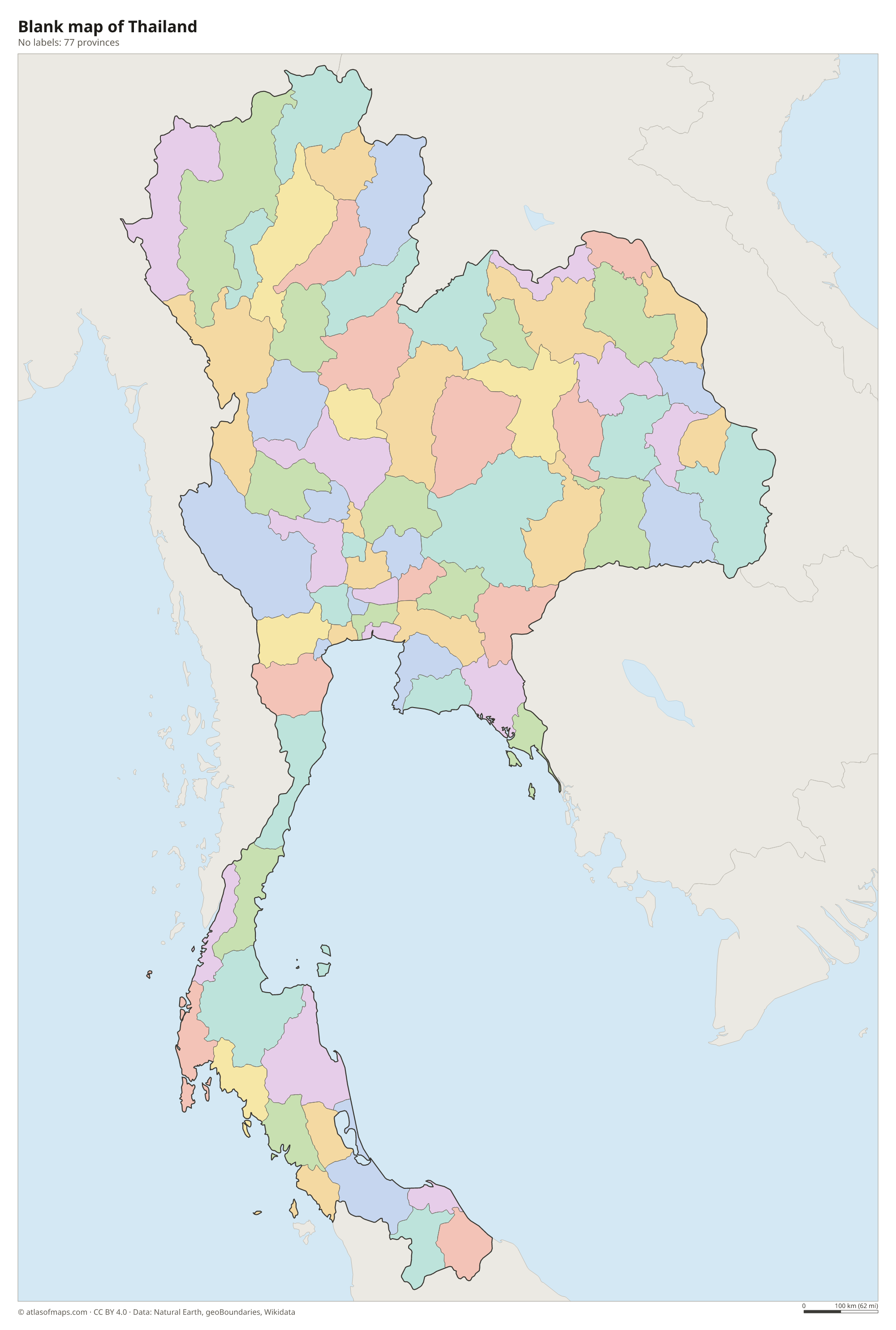
Blank map of Thailand

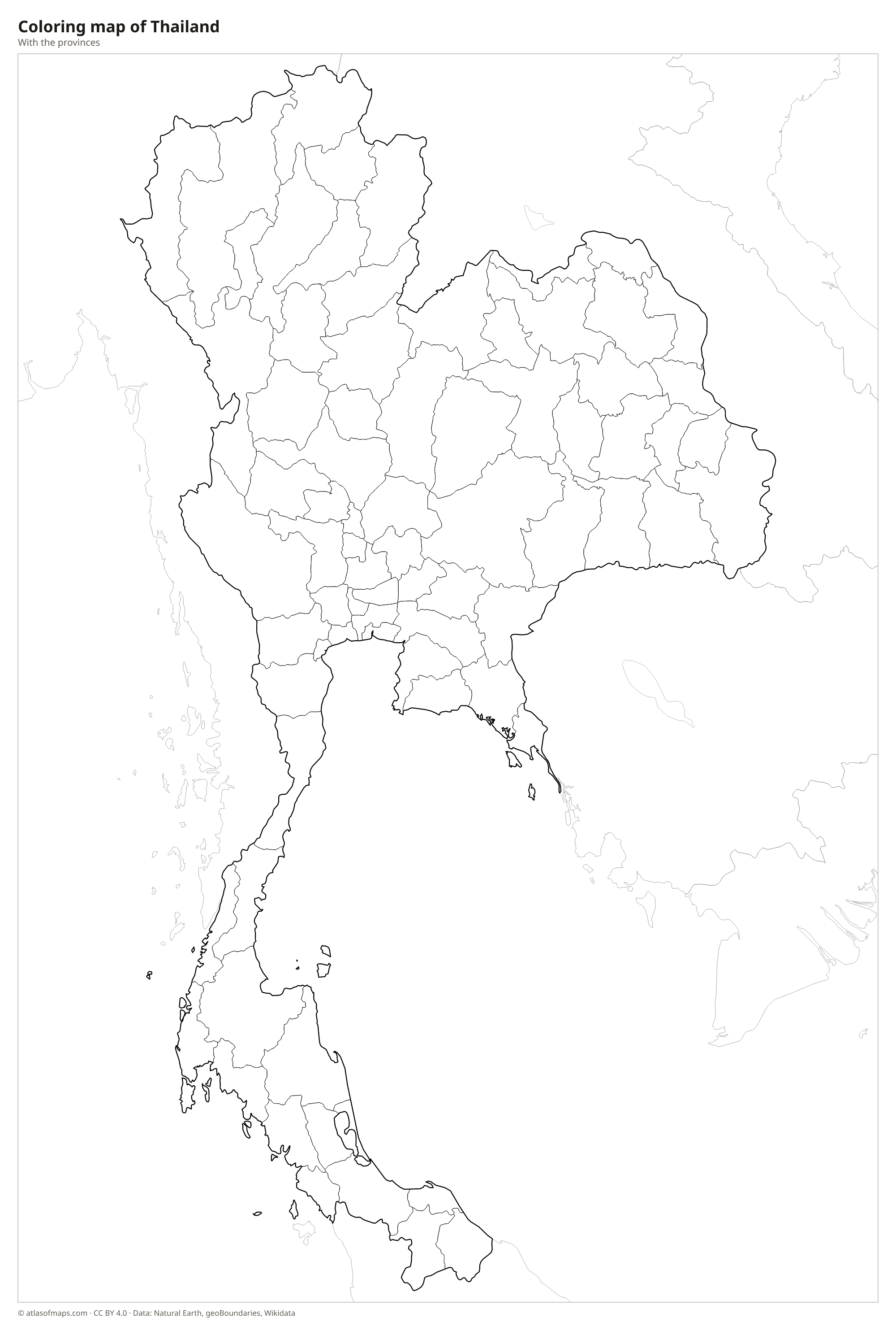
Coloring map of Thailand

Geography of Thailand
Thailand covers about 513,120 km² (198,117 sq mi), and its outline is often compared to the head of an elephant, with the trunk formed by the long southern peninsula. The north is mountainous, with forested ranges and valleys; Doi Inthanon, near Chiang Mai, is the highest point at 2,565 m (8,415 ft). The northeast, called Isan, sits on the Khorat Plateau, a dry, flat upland. The heart of the country is the fertile central plain, while the south stretches down the Malay Peninsula and narrows at the Isthmus of Kra.
The Chao Phraya River, formed where the Ping and Nan rivers meet, crosses the central plain and passes through Bangkok before reaching the Gulf of Thailand; its basin is the country's rice bowl. The Mekong forms much of the border with Laos in the northeast. Thailand has a tropical climate with a hot season, a rainy season brought by the southwest monsoon, and a cooler dry season. The southern coasts, with islands such as Phuket on the Andaman Sea and Ko Samui in the gulf, are lined with beaches, limestone cliffs and coral reefs.
Fun facts
- Thailand is the only country in Southeast Asia that was never colonized by a European power.
- The full ceremonial name of Bangkok in Thai is one of the longest place names in the world.
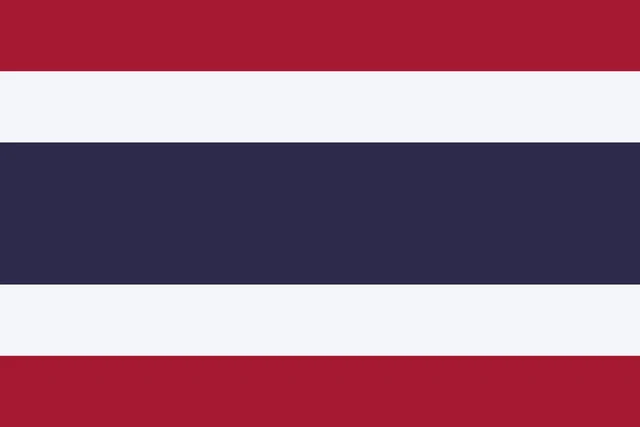
Flag of Thailand
The flag of Thailand has five horizontal stripes: red, white, blue, white and red. The blue stripe in the middle is twice as tall as each of the other four. The flag is called the Trairong, meaning tricolor, and it carries no emblem or writing.
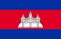
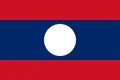
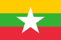
Countries bordering Thailand
Frequently asked questions
What countries border Thailand?
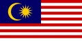
Thailand borders four countries: Myanmar to the west and north, Laos to the northeast, Cambodia to the southeast and Malaysia to the south.
How many provinces does Thailand have?
Thailand has 77 provinces, counting Bangkok. Nakhon Ratchasima in the northeast is the largest by area, while Samut Songkhram, near Bangkok, is the smallest.
What is the capital of Thailand?
Bangkok is the capital and by far the largest city of Thailand. It lies on the Chao Phraya River, a short distance from where the river flows into the Gulf of Thailand.
What language is spoken in Thailand?
The official language is Thai.
Can I print the map of Thailand?
Yes. Every map on this page can be downloaded for free as PNG or PDF (US Letter) and printed, including the blank map and the coloring map. Please credit the source (Atlas of Maps, CC BY 4.0).
Use this map
You can download, print and share this map for free, in class, in school projects, in presentations and on websites, as long as you credit the source: Map of Thailand · Atlas of Maps (atlasofmaps.com), license CC BY 4.0.
See also: Map of Asia · Map of Southeast Asia · World map