Map of New Caledonia with regions and capitals
New Caledonia is a French overseas collectivity in the southwest Pacific Ocean, in Melanesia, east of Australia. It has no land borders; its nearest neighbors are Vanuatu to the northeast and Australia across the Coral Sea to the west. The political map shows its 3 regions, the capital, Nouméa, and major cities.
French overseas collectivity.

- Capital
- Nouméa
- Population
- 278,500 (2017)
- Area
- 18,576 km² (7,172 sq mi)
- Population density
- 15 per km² (39 per sq mi)
- Official language
- French
- Currency
- CFP Franc
- Demonym
- New Caledonian
- Regions
- 3
- Calling code
- +687
- Internet domain
- .nc
Where is New Caledonia?
New Caledonia is a French overseas collectivity in the southwest Pacific Ocean, in Melanesia, east of Australia. It has no land borders; its nearest neighbors are Vanuatu to the northeast and Australia across the Coral Sea to the west.

Regions of New Caledonia and their capitals
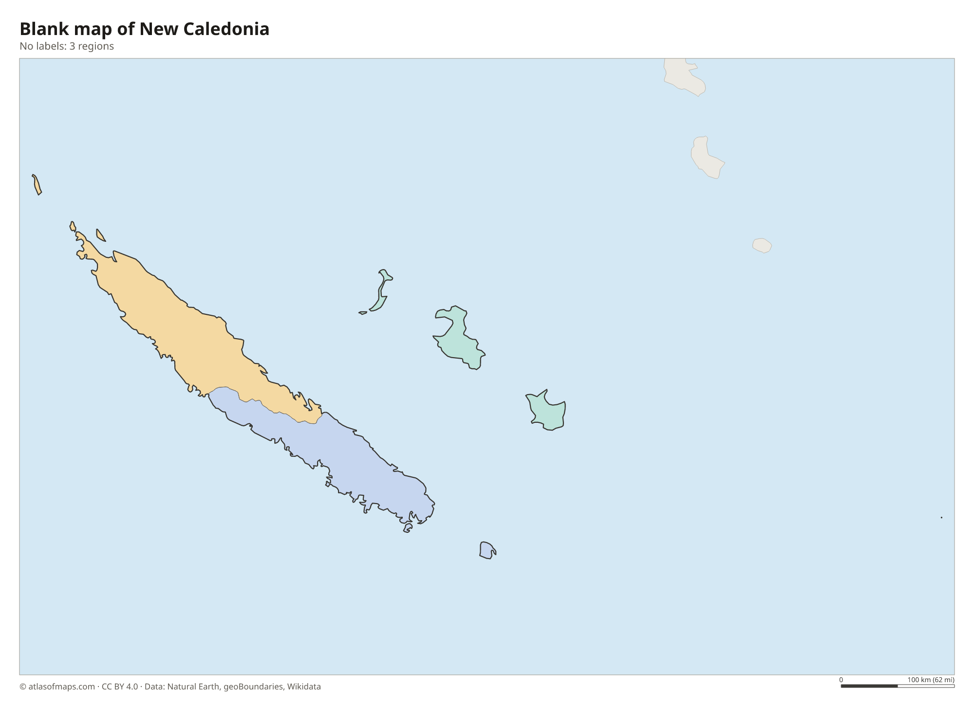
New Caledonia is divided into 3 provinces, the units on the map: the North Province and the South Province on Grande Terre, and the Loyalty Islands Province to the east. The South Province includes Nouméa and most of the population.
| Region | Capital | Population | Area |
|---|---|---|---|
| Loyalty Islands | — | 18,671 | 1,981 km² (765 sq mi) |
| North | Koné | 50,947 | 9,583 km² (3,700 sq mi) |
| South | Nouméa | 194,978 | 7,012 km² (2,707 sq mi) |
Population from Wikidata (latest figure available for each region).
Blank and coloring maps of New Caledonia
Blank map of New Caledonia

Coloring map of New Caledonia

Geography of New Caledonia
New Caledonia covers 18,576 km² (7,172 sq mi). Its main island, Grande Terre, is long and narrow, with a mountain chain running down its length. The highest summits, Mont Panié in the north and Mont Humboldt in the south, rise above dense forests, while the south has red, nickel-rich soils covered in scrub. East of Grande Terre lie the low coral Loyalty Islands, including Lifou, Maré and Ouvéa, and to the south is the Isle of Pines.
A barrier reef, one of the longest in the world, encircles Grande Terre and encloses a huge lagoon; the lagoons of New Caledonia are a UNESCO World Heritage Site. The east coast faces the trade winds and is wetter and greener, while the west coast is drier, with savanna and mangroves. Short, fast rivers run from the mountains to the sea. The climate is tropical, with a warm, wet season from about November to April, when cyclones can occur.
Fun facts
- New Caledonia holds a large share of the world's known nickel reserves, and mining is its main industry.
- The kagu, a gray, nearly flightless bird found only on Grande Terre, is the territory's emblem.
- Grande Terre is an old fragment of continental crust, and many of its plants are found nowhere else.
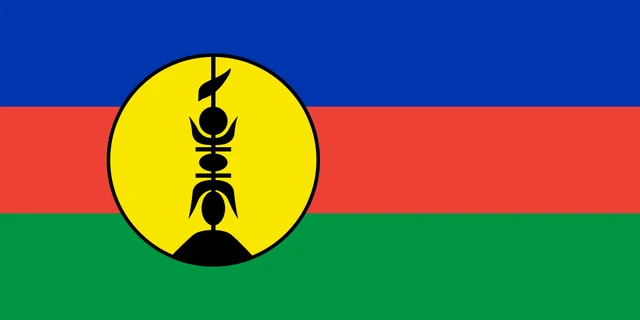
Flag of New Caledonia
New Caledonia flies two flags side by side: the French tricolor and the Kanak flag. The Kanak flag has three horizontal bands of blue, red and green, with a large yellow disc edged in black near the hoist. Inside the disc is a black flèche faîtière, the carved wooden spire that tops a traditional Kanak house.
Frequently asked questions
Is New Caledonia a country?
New Caledonia is not an independent country. It is a French overseas collectivity with wide self-government, and its residents are French citizens who use the CFP franc.
How many provinces does New Caledonia have?
New Caledonia has 3 provinces: the North Province, the South Province and the Loyalty Islands Province. The South Province, around the capital Nouméa, is the most populous.
Where is New Caledonia?
New Caledonia lies in the southwest Pacific Ocean, east of Australia, north of New Zealand and southwest of Vanuatu. It is part of the region of Melanesia.
What is the capital of New Caledonia?
The capital of New Caledonia is Nouméa.
What countries border New Caledonia?
New Caledonia has no land borders with other countries.
What language is spoken in New Caledonia?
The official language is French.
Can I print the map of New Caledonia?
Yes. Every map on this page can be downloaded for free as PNG or PDF (US Letter) and printed, including the blank map and the coloring map. Please credit the source (Atlas of Maps, CC BY 4.0).
Use this map
You can download, print and share this map for free, in class, in school projects, in presentations and on websites, as long as you credit the source: Map of New Caledonia · Atlas of Maps (atlasofmaps.com), license CC BY 4.0.
See also: Map of Oceania · World map