Map of North Korea
North Korea is a country in East Asia, on the northern half of the Korean Peninsula. It borders China and Russia to the north and South Korea to the south, with the Yellow Sea to the west and the Sea of Japan (East Sea) to the east. The political map shows its regions, the capital, Pyongyang, and major cities.

- Capital
- Pyongyang
- Population
- 26.4 million (2023)
- Area
- 120,540 km² (46,541 sq mi)
- Population density
- 219 per km² (568 per sq mi)
- Official languages
- North Korean standard language and Korean
- Currency
- North Korean won
- Demonym
- North Korean
- Highest point
- Baekdu Mountain (2,744 m (9,003 ft))
- Calling code
- +850
- Internet domain
- .kp
- Official name
- Democratic People's Republic of Korea
Where is North Korea?
North Korea is a country in East Asia, on the northern half of the Korean Peninsula. It borders China and Russia to the north and South Korea to the south, with the Yellow Sea to the west and the Sea of Japan (East Sea) to the east.
Neighboring countries: China, South Korea, Russia.

Regions of North Korea and their capitals
North Korea is divided into provinces and special cities, and the map draws them from Natural Earth data. The country has changed some of its divisions in recent years, so the borders on the map may not match the current official ones.
The divisions on the map come from Natural Earth and may not reflect the latest territorial reform in North Korea.
| Region | Capital | Population | Area |
|---|---|---|---|
| Chagang | Kanggye | 1,299,830 | 16,613 km² (6,414 sq mi) |
| Kangwon | Wonsan | 1,477,582 | 11,255 km² (4,346 sq mi) |
| North Hamgyong | Chongjin | 2,327,362 | 20,345 km² (7,855 sq mi) |
| North Hwanghae | Sariwon | 2,113,672 | 8,154 km² (3,148 sq mi) |
| North Pyongan | Sinuiju | 2,728,662 | 12,191 km² (4,707 sq mi) |
| Pyongyang | Pyongyang | 2,863,000 | 3,194 km² (1,233 sq mi) |
| Rason | — | 196,954 | 746 km² (288 sq mi) |
| Ryanggang | Hyesan | 719,269 | 14,317 km² (5,528 sq mi) |
| South Hamgyong | Hamhung | 3,066,013 | 18,970 km² (7,324 sq mi) |
| South Hwanghae | Haeju | 2,310,485 | 8,450 km² (3,263 sq mi) |
| South Pyongan | Pyongsong | 4,051,696 | 12,330 km² (4,761 sq mi) |
Population from Wikidata (latest figure available for each region).
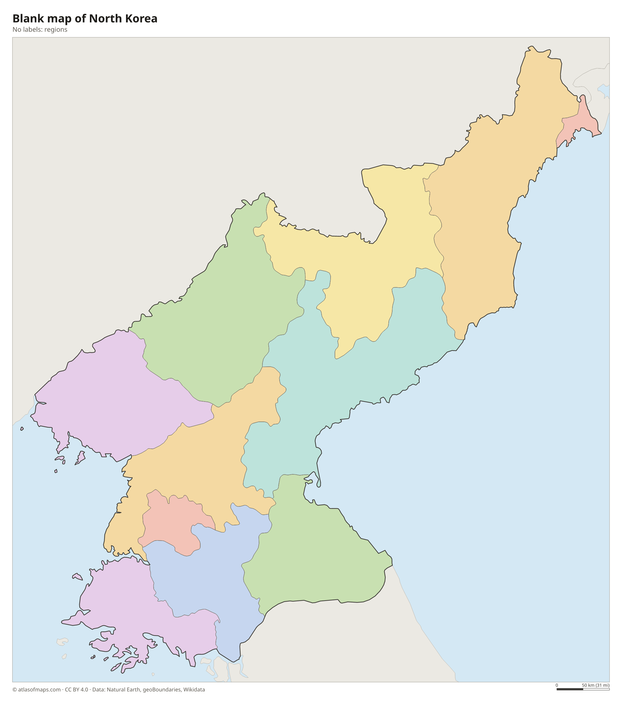
Blank and coloring maps of North Korea
Blank map of North Korea

Coloring map of North Korea

Geography of North Korea
North Korea covers 120,540 km² (46,541 sq mi), and most of it is mountains and hills. The rugged north and east hold the Kaema Plateau, often called the roof of Korea, and the Nangnim and Hamgyong ranges. On the Chinese border rises Baekdu Mountain (Paektu), a volcano with a crater lake, Heaven Lake, at its summit; at 2,744 m (9,003 ft), it is the highest point on the Korean Peninsula. Lowland plains are found mainly along the west coast, around Pyongyang.
Two rivers form almost the entire northern border: the Yalu flows west to the Yellow Sea, and the Tumen flows east to the Sea of Japan, where its last stretch separates North Korea from Russia. The Taedong River runs through Pyongyang. To the south, the Demilitarized Zone, a heavily guarded strip about 4 km (2.5 mi) wide, separates North Korea from South Korea. The climate is continental, with long, very cold winters and hot, rainy summers.
Fun facts
- Heaven Lake, in the crater of Baekdu Mountain, is shared by North Korea and China.
- North Korea's border with Russia is very short, less than 20 km (12 mi), along the lower Tumen River.
- Mount Kumgang, the Diamond Mountains near the east coast, is a granite range famous for its jagged peaks.
Flag of North Korea
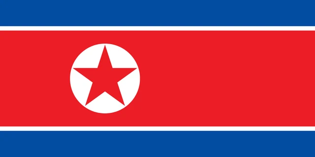
The flag of North Korea has a wide red horizontal band in the center, bordered above and below by thin white stripes and broader blue bands at the top and bottom. Near the hoist, the red band holds a white disc with a red five-pointed star. The flag has a 1:2 ratio.
Countries bordering North Korea
Frequently asked questions
What countries border North Korea?
North Korea borders three countries: China along the Yalu and Tumen rivers, Russia along a short stretch of the Tumen, and South Korea across the Demilitarized Zone.
What is the capital of North Korea?
Pyongyang is the capital and largest city. It lies on the Taedong River in the western lowlands, not far from the Yellow Sea.
What seas surround North Korea?
North Korea has two coasts: the Yellow Sea and Korea Bay to the west, and the Sea of Japan, called the East Sea in Korea, to the east.
What language is spoken in North Korea?
The official languages are North Korean standard language and Korean.
Can I print the map of North Korea?
Yes. Every map on this page can be downloaded for free as PNG or PDF (US Letter) and printed, including the blank map and the coloring map. Please credit the source (Atlas of Maps, CC BY 4.0).
Use this map
You can download, print and share this map for free, in class, in school projects, in presentations and on websites, as long as you credit the source: Map of North Korea · Atlas of Maps (atlasofmaps.com), license CC BY 4.0.
See also: Map of Asia · World map