Map of Estonia with regions and capitals
Estonia is the northernmost of the three Baltic states in northern Europe. It borders Latvia to the south and Russia to the east, with the Gulf of Finland to the north and the Baltic Sea and the Gulf of Riga to the west. The political map shows its 15 regions, the capital, Tallinn, and major cities.

- Capital
- Tallinn
- Population
- 1.4 million (2025)
- Area
- 45,335 km² (17,504 sq mi)
- Population density
- 30 per km² (78 per sq mi)
- Official language
- Estonian
- Currency
- euro
- Demonym
- Estonian
- Regions
- 15
- Highest point
- Suur Munamägi (317 m (1,040 ft))
- Calling code
- +372
- Internet domain
- .ee
Where is Estonia?
Estonia is the northernmost of the three Baltic states in northern Europe. It borders Latvia to the south and Russia to the east, with the Gulf of Finland to the north and the Baltic Sea and the Gulf of Riga to the west.

Regions of Estonia and their capitals
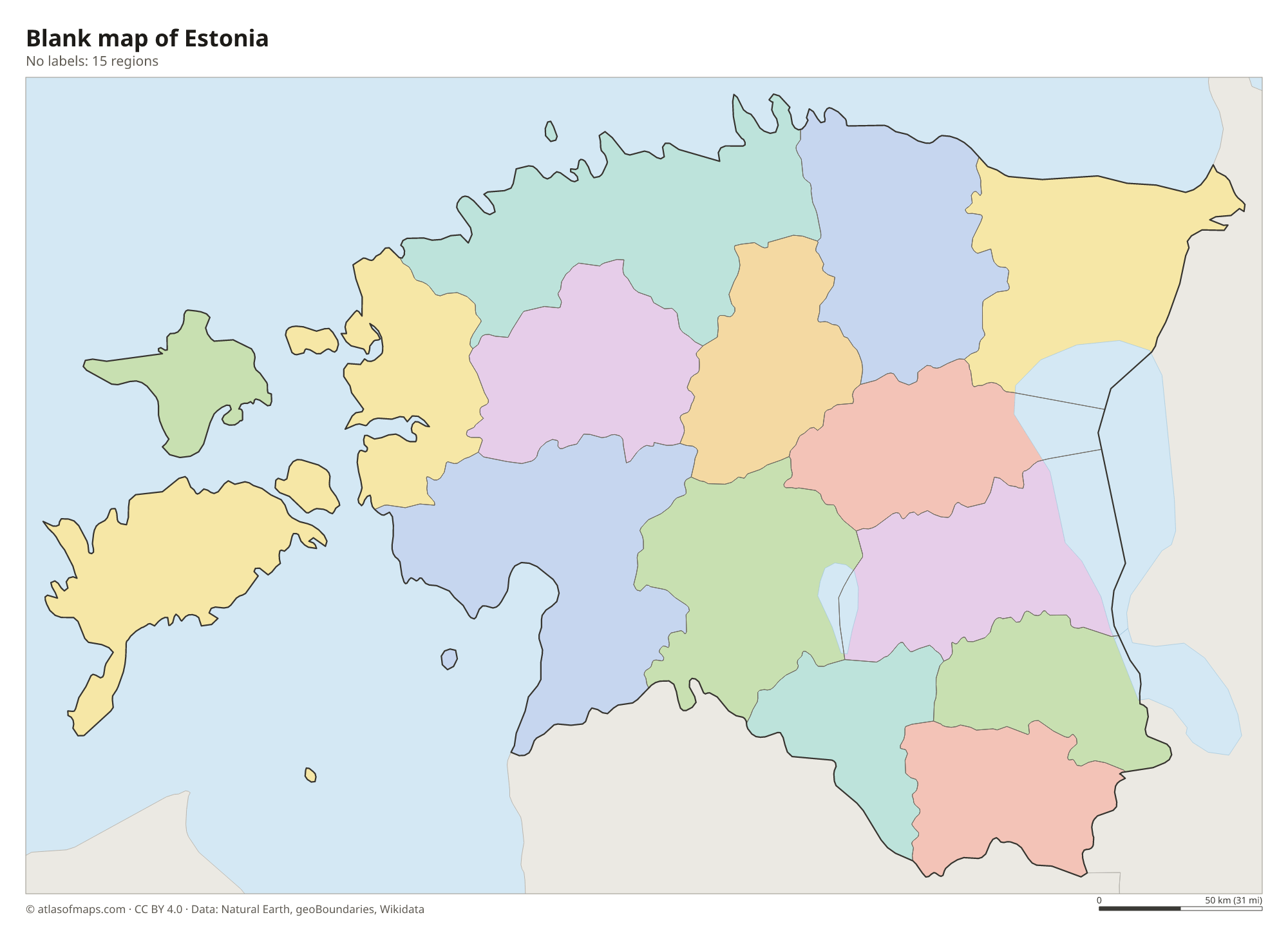
Estonia is divided into 15 counties (maakonnad), shown on the map as regions. Harju County contains the capital, Tallinn, while Saare and Hiiu counties cover the large islands off the west coast.
| Region | Capital | Population | Area |
|---|---|---|---|
| Harju | Tallinn | 646,315 | 4,327 km² (1,671 sq mi) |
| Hiiu | Kärdla | 8,418 | 1,032 km² (398 sq mi) |
| Ida-Viru | Jõhvi | 133,358 | 2,972 km² (1,147 sq mi) |
| Järva | Paide | 30,072 | 2,674 km² (1,032 sq mi) |
| Jõgeva | Jõgeva | 27,739 | 2,545 km² (983 sq mi) |
| Lääne | Haapsalu | 20,625 | 1,816 km² (701 sq mi) |
| Lääne-Viru | Rakvere | 59,608 | 3,696 km² (1,427 sq mi) |
| Pärnu | Pärnu | 87,418 | 5,419 km² (2,092 sq mi) |
| Põlva | Põlva | 24,036 | 1,823 km² (704 sq mi) |
| Rapla | Rapla | 34,038 | 2,765 km² (1,068 sq mi) |
| Saare | Kuressaare | 32,021 | 2,938 km² (1,134 sq mi) |
| Tartu | Tartu | 162,390 | 3,349 km² (1,293 sq mi) |
| Valga | Valga | 27,924 | 1,917 km² (740 sq mi) |
| Viljandi | Viljandi | 45,637 | 3,420 km² (1,320 sq mi) |
| Võru | Võru | 34,049 | 2,773 km² (1,071 sq mi) |
Population from Wikidata (latest figure available for each region).
Blank and coloring maps of Estonia
Blank map of Estonia

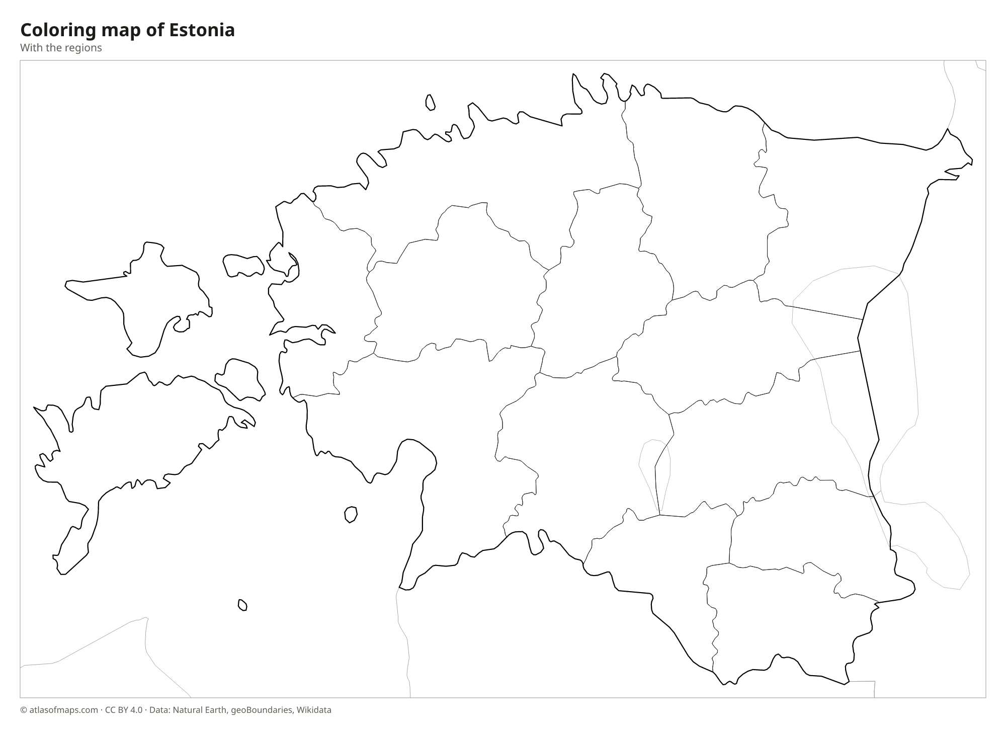
Coloring map of Estonia

Geography of Estonia
Estonia covers 45,335 km² (17,504 sq mi), and part of that is spread over more than 2,000 islands, the largest of which are Saaremaa and Hiiumaa off the west coast. The mainland is low and flat, shaped by ice-age glaciers that left moraines, drumlins and many lakes. Along the north coast runs the Baltic Klint, a limestone cliff edge. The land rises only in the southeast, in the Haanja Upland, where Suur Munamägi reaches 317 m (1,040 ft), the highest point in the Baltic states.
About half of Estonia is covered by forest, and bogs and wetlands take up much of the rest of the countryside. Lake Peipus, on the border with Russia, is one of the largest lakes in Europe, and the Narva River carries its water north to the Gulf of Finland. Võrtsjärv is the largest lake entirely inside the country. The climate is cool and temperate, with snowy winters and mild summers, and around midsummer the nights are very short and light.
Fun facts
- The Kaali crater field on Saaremaa was formed by a meteorite impact a few thousand years ago.
- Tallinn's medieval Old Town is one of the best-preserved Hanseatic towns in Europe and a UNESCO World Heritage Site.
- Suur Munamägi, only 317 m (1,040 ft) high, is the highest point in all three Baltic states.
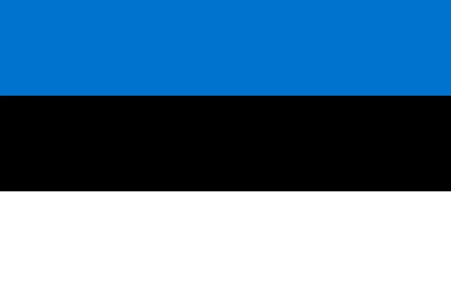
Flag of Estonia
The flag of Estonia is a horizontal tricolor of blue, black and white, in three bands of equal height. It carries no emblem. In Estonian it is called sinimustvalge, which simply means blue-black-white. The official proportions are 7:11, so the flag is slightly longer in relation to its height than the common 2:3 shape.
Countries bordering Estonia
Frequently asked questions
What countries border Estonia?
Estonia borders Latvia to the south and Russia to the east, where the border follows the Narva River and Lake Peipus. Finland lies about 80 km (50 mi) north across the Gulf of Finland.
How many counties does Estonia have?
Estonia has 15 counties, such as Harju, Tartu, Pärnu and Ida-Viru. Harju County contains the capital, Tallinn, and the islands of Saaremaa and Hiiumaa form counties of their own.
Is Estonia in Eastern or Northern Europe?
Estonia is usually counted as part of Northern Europe, as a Baltic state with close ties to the Nordic countries, especially Finland. Because of its history, it is sometimes grouped with Eastern Europe.
What is the capital of Estonia?
The capital of Estonia is Tallinn.
How many regions does Estonia have?
Estonia is divided into 15 regions: Harju, Hiiu, Ida-Viru, Järva, Jõgeva, Lääne, Lääne-Viru, Pärnu, Põlva, Rapla, Saare, Tartu, Valga, Viljandi, and Võru.
What language is spoken in Estonia?
The official language is Estonian.
Can I print the map of Estonia?
Yes. Every map on this page can be downloaded for free as PNG or PDF (US Letter) and printed, including the blank map and the coloring map. Please credit the source (Atlas of Maps, CC BY 4.0).
Use this map
You can download, print and share this map for free, in class, in school projects, in presentations and on websites, as long as you credit the source: Map of Estonia · Atlas of Maps (atlasofmaps.com), license CC BY 4.0.
See also: Map of Europe · Map of the European Union · World map