Map of Papua New Guinea with regions and capitals
Papua New Guinea is a country in Oceania, north of Australia, made up of the eastern half of the island of New Guinea and many smaller islands. Its only land neighbor is Indonesia to the west, and the Pacific Ocean, the Coral Sea and the Solomon Sea surround it. The political map shows its 20 regions, the capital, Port Moresby, and major cities.

- Capital
- Port Moresby
- Population
- 8.9 million (2020)
- Area
- 462,840 km² (178,704 sq mi)
- Population density
- 19 per km² (50 per sq mi)
- Official languages
- English, Tok Pisin, and Hiri Motu
- Currency
- kina
- Demonym
- Papua New Guinean
- Regions
- 20
- Highest point
- Mount Wilhelm (4,509 m (14,793 ft))
- Calling code
- +675
- Internet domain
- .pg
Where is Papua New Guinea?
Papua New Guinea is a country in Oceania, north of Australia, made up of the eastern half of the island of New Guinea and many smaller islands. Its only land neighbor is Indonesia to the west, and the Pacific Ocean, the Coral Sea and the Solomon Sea surround it.
Neighboring countries: Indonesia.

Regions of Papua New Guinea and their capitals
The map shows 20 provincial-level units: provinces such as Morobe, Madang and East Sepik, the National Capital District around Port Moresby and the Autonomous Region of Bougainville. The newer highland provinces of Hela and Jiwaka are not drawn separately.
| Region | Capital | Population | Area |
|---|---|---|---|
| Bougainville | Buka | 367,093 | 9,384 km² (3,623 sq mi) |
| Central | Port Moresby | — | 29,998 km² (11,582 sq mi) |
| Chimbu | Kundiawa | 376,473 | 6,134 km² (2,368 sq mi) |
| East New Britain | Kokopo | — | 15,724 km² (6,071 sq mi) |
| East Sepik | — | 450,530 | 43,671 km² (16,861 sq mi) |
| Eastern Highlands | Goroka | 579,825 | 11,157 km² (4,308 sq mi) |
| Enga | Wabag | 571,060 | 11,704 km² (4,519 sq mi) |
| Gulf | Kerema | 158,197 | 34,472 km² (13,310 sq mi) |
| Madang | Madang | — | 28,886 km² (11,153 sq mi) |
| Manus | Lorengau | — | 2,000 km² (772 sq mi) |
| Milne Bay | Alotau | — | 14,345 km² (5,539 sq mi) |
| Morobe | Lae | — | 33,705 km² (13,014 sq mi) |
| New Ireland | Kavieng | — | — |
| Oro | Popondetta | — | 22,735 km² (8,778 sq mi) |
| Port Moresby | Port Moresby | 317,374 | 240 km² (93 sq mi) |
| Sandaun | Vanimo | — | 35,820 km² (13,830 sq mi) |
| Southern Highlands | Mendi | 510,245 | 15,098 km² (5,829 sq mi) |
| West New Britain | Kimbe | — | 20,387 km² (7,871 sq mi) |
| Western | Daru | — | 98,189 km² (37,911 sq mi) |
| Western Highlands | Mount Hagen | — | 4,299 km² (1,660 sq mi) |
Population from Wikidata (latest figure available for each region).
Blank and coloring maps of Papua New Guinea
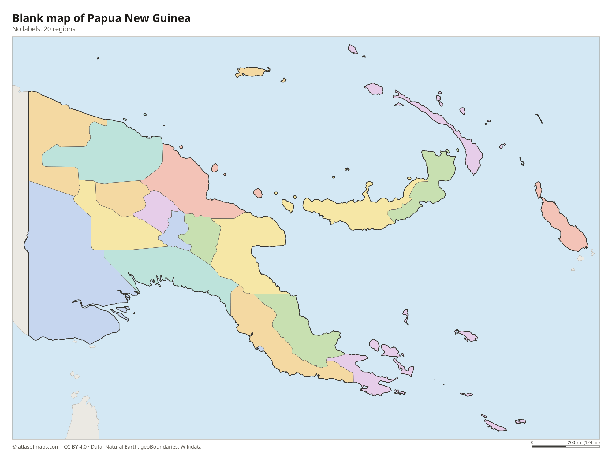
Blank map of Papua New Guinea

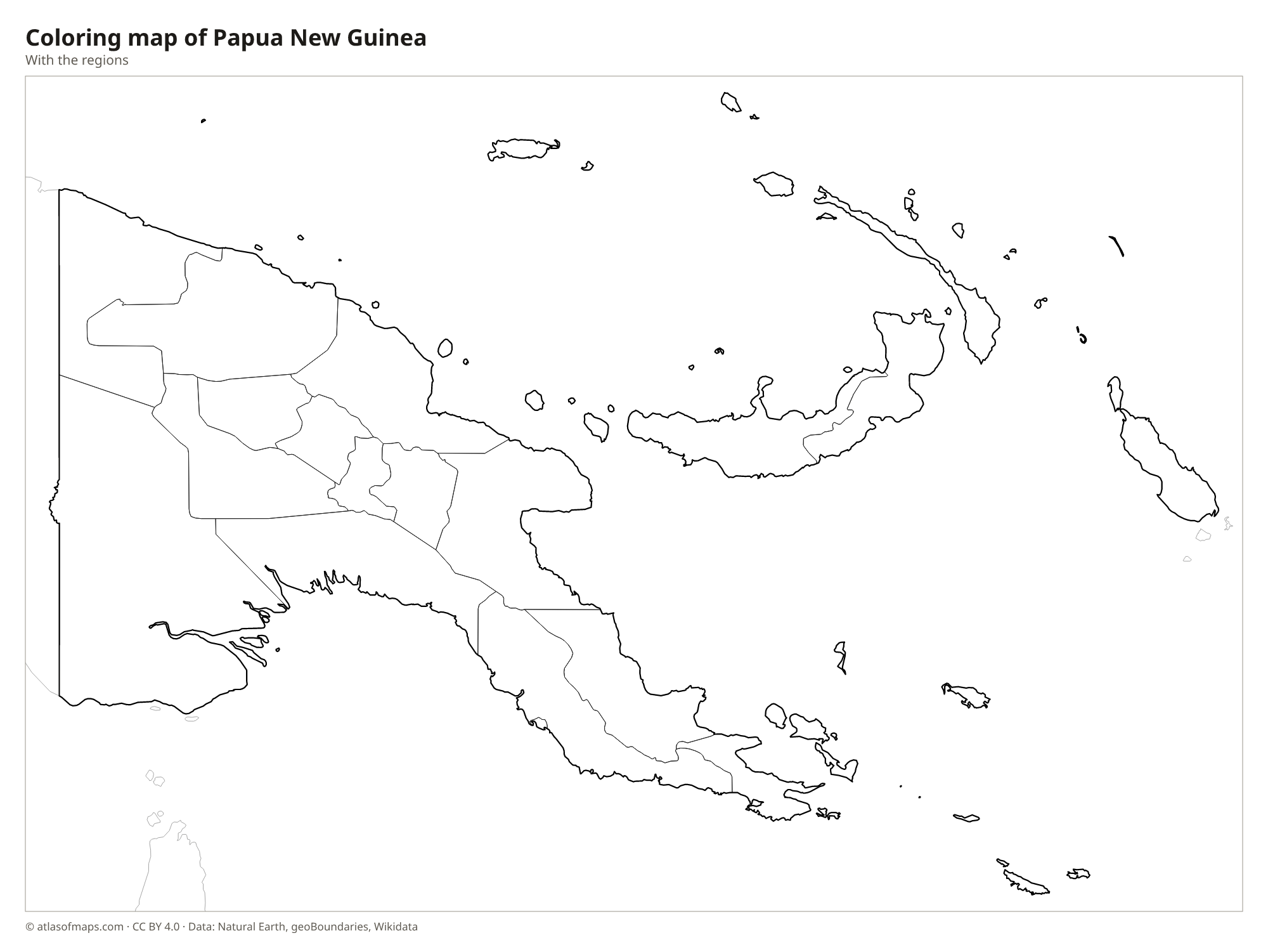
Coloring map of Papua New Guinea

Geography of Papua New Guinea
A rugged central cordillera runs the length of mainland Papua New Guinea. Its highlands include broad, fertile valleys at high altitude, where much of the population lives, and peaks such as Mount Wilhelm, the highest point at 4,509 m (14,793 ft). The Owen Stanley Range forms the island's southeastern tail, while the south and west have vast lowland swamps and plains. Offshore lie the volcanic islands of New Britain, New Ireland and Bougainville, the Admiralty Islands around Manus, and hundreds of smaller islands and atolls. The country sits on the Pacific Ring of Fire and has many active volcanoes.
Two great rivers drain the mainland: the Sepik flows north into the Bismarck Sea, and the Fly flows south into the Gulf of Papua near the border with Indonesia. Both wind through huge wetlands. Tropical rainforest covers much of the land, and the coasts are lined with mangroves and coral reefs. The climate is hot and humid in the lowlands, with heavy rain, while the highland valleys are much cooler and the highest peaks occasionally see snow. The Torres Strait separates the country from the Cape York Peninsula of Australia.
Fun facts
- More than 800 languages are spoken in Papua New Guinea, more than in any other country.
- New Guinea, which Papua New Guinea shares with Indonesia, is the second-largest island in the world after Greenland.
- Port Moresby, the capital, lies on the southeastern coast of the mainland, facing the Gulf of Papua.
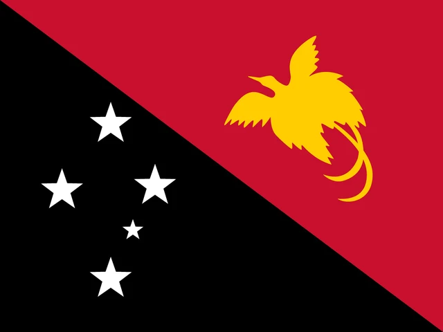
Flag of Papua New Guinea
The flag of Papua New Guinea is divided diagonally from the upper hoist corner to the lower fly corner. The lower hoist triangle is black and carries five white stars in the pattern of the Southern Cross. The upper fly triangle is red and shows a yellow bird of paradise in flight.
Countries bordering Papua New Guinea
Frequently asked questions
What country borders Papua New Guinea?
Indonesia is Papua New Guinea's only land neighbor; the two countries share the island of New Guinea along a mostly straight north-south border. Australia lies to the south across the Torres Strait.
How many provinces does Papua New Guinea have?
The map shows 20 provincial-level divisions, including the National Capital District and the Autonomous Region of Bougainville. Two newer highland provinces, Hela and Jiwaka, are not drawn separately.
What is the capital of Papua New Guinea?
The capital and largest city is Port Moresby, on the southeastern coast of the mainland. It is not connected by road to the highlands, so most travel inland goes by air.
What language is spoken in Papua New Guinea?
The official languages are English, Tok Pisin, and Hiri Motu.
Can I print the map of Papua New Guinea?
Yes. Every map on this page can be downloaded for free as PNG or PDF (US Letter) and printed, including the blank map and the coloring map. Please credit the source (Atlas of Maps, CC BY 4.0).
Use this map
You can download, print and share this map for free, in class, in school projects, in presentations and on websites, as long as you credit the source: Map of Papua New Guinea · Atlas of Maps (atlasofmaps.com), license CC BY 4.0.
See also: Map of Oceania · World map