Map of Finland with regions and capitals
Finland is a Nordic country in northern Europe, between Sweden to the west, Norway to the north and Russia to the east. The Gulf of Bothnia lies to its west and the Gulf of Finland to its south, with Estonia beyond. The political map shows its 18 regions, the capital, Helsinki, and major cities.

- Capital
- Helsinki
- Population
- 5.7 million (2025)
- Area
- 338,478 km² (130,687 sq mi)
- Population density
- 17 per km² (43 per sq mi)
- Official languages
- Finnish and Swedish
- Currency
- euro
- Demonym
- Finnish
- Regions
- 18
- Highest point
- Halti (1,361 m (4,465 ft))
- Calling code
- +358
- Internet domain
- .fi
Where is Finland?
Finland is a Nordic country in northern Europe, between Sweden to the west, Norway to the north and Russia to the east. The Gulf of Bothnia lies to its west and the Gulf of Finland to its south, with Estonia beyond.

Regions of Finland and their capitals
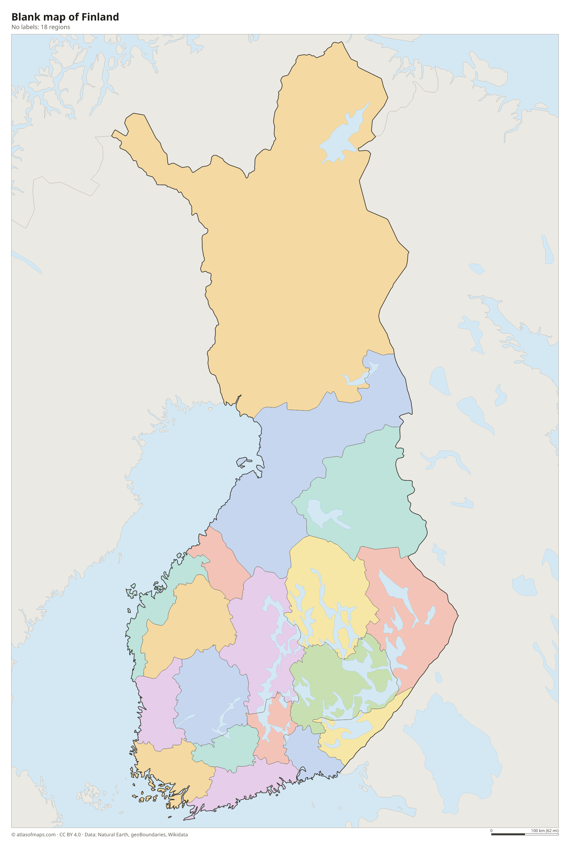
Finland is divided into 18 regions (maakunta) on the map, from Uusimaa around Helsinki in the south to Lapland in the north. The self-governing Åland Islands, a Swedish-speaking archipelago in the southwest, have a special autonomous status.
| Region | Capital | Population | Area |
|---|---|---|---|
| Central Finland | Jyväskylä | 273,731 | 19,012 km² (7,341 sq mi) |
| Central Ostrobothnia | Kokkola | 67,498 | 5,220 km² (2,015 sq mi) |
| Finland Proper | Turku | 497,800 | 10,912 km² (4,213 sq mi) |
| Kainuu | Kajaani | 69,193 | 22,688 km² (8,760 sq mi) |
| Kymenlaakso | Kotka | 156,198 | 4,948 km² (1,910 sq mi) |
| Lapland | Rovaniemi | 176,215 | 92,683 km² (35,785 sq mi) |
| North Karelia | Joensuu | 161,418 | 22,903 km² (8,843 sq mi) |
| Northern Ostrobothnia | Oulu | 417,939 | 39,193 km² (15,133 sq mi) |
| Northern Savonia | Kuopio | 248,512 | 21,078 km² (8,138 sq mi) |
| Ostrobothnia | Vaasa | 179,555 | 7,936 km² (3,064 sq mi) |
| Päijänne Tavastia | Lahti | 204,522 | 6,942 km² (2,680 sq mi) |
| Pirkanmaa | Tampere | 548,910 | 15,550 km² (6,004 sq mi) |
| Satakunta | Pori | 210,112 | 8,269 km² (3,193 sq mi) |
| South Karelia | Lappeenranta | 124,238 | 6,872 km² (2,653 sq mi) |
| Southern Ostrobothnia | Seinäjoki | 189,474 | 13,999 km² (5,405 sq mi) |
| Southern Savonia | Mikkeli | 128,144 | 17,099 km² (6,602 sq mi) |
| Tavastia Proper | Hämeenlinna | 168,957 | 5,708 km² (2,204 sq mi) |
| Uusimaa | Helsinki | 1,799,629 | 9,569 km² (3,695 sq mi) |
Population from Wikidata (latest figure available for each region).
Blank and coloring maps of Finland
Blank map of Finland

Coloring map of Finland

Geography of Finland
Finland covers 338,478 km² (130,687 sq mi), and about a quarter of it lies north of the Arctic Circle. Most of the land is low and gently rolling, scraped by ice-age glaciers that left ridges, eskers and countless rocky basins. The Salpausselkä ridges cross the south, marking where the retreating ice sheet once paused. The terrain rises only in Lapland, in the far northwest, where the fells reach their highest point on the slopes of Halti, on the border with Norway. Forests cover roughly three quarters of the country.
Finland is known as the land of a thousand lakes, but it actually has about 188,000 lakes, many linked by rivers and channels. Saimaa, in the southeastern Lakeland, is the largest. The coast is fringed by tens of thousands of islands, especially in the Archipelago Sea and around the autonomous Åland Islands in the southwest. Because the land is still rising after the last ice age, the coastline slowly moves outward. Winters are long and cold, especially in Lapland, where the sun does not set for weeks in summer.
Fun facts
- Finland's highest ground lies on the slopes of Halti, whose summit is just across the border in Norway.
- Because the land is still rising after the ice age, Finland gains a few square kilometers of new land from the sea every year.
- In the far north, the sun stays above the horizon for more than two months in summer.
Flag of Finland
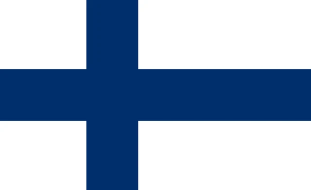
The flag of Finland is white with a blue Nordic cross. The vertical arm of the cross is set toward the hoist side, as on the other Nordic flags. The official proportions are 11:18, and the state flag adds the Finnish coat of arms at the center of the cross.
Countries bordering Finland
Frequently asked questions
What countries border Finland?
Finland borders three countries: Sweden to the northwest, Norway to the north and Russia to the east. Estonia lies across the Gulf of Finland, about 80 km (50 mi) south of Helsinki.
How many regions does Finland have?
Finland has 18 regions on the mainland, such as Uusimaa, Pirkanmaa and Lapland. The Åland Islands, which have their own parliament, form an additional self-governing region.
How many lakes does Finland have?
Finland has about 188,000 lakes, which is why it is often called the land of a thousand lakes. The largest is Saimaa, in the eastern Lakeland region.
What is the capital of Finland?
The capital of Finland is Helsinki.
What language is spoken in Finland?
The official languages are Finnish and Swedish.
Can I print the map of Finland?
Yes. Every map on this page can be downloaded for free as PNG or PDF (US Letter) and printed, including the blank map and the coloring map. Please credit the source (Atlas of Maps, CC BY 4.0).
Use this map
You can download, print and share this map for free, in class, in school projects, in presentations and on websites, as long as you credit the source: Map of Finland · Atlas of Maps (atlasofmaps.com), license CC BY 4.0.
See also: Map of Europe · Map of the European Union · World map