Map of Norway
Norway is a country in Northern Europe, on the western and northern part of the Scandinavian Peninsula. It borders Sweden to the east and Finland and Russia in the far northeast, with coasts on the North Sea, the Norwegian Sea and the Barents Sea. The political map shows its counties, the capital, Oslo, and major cities.

- Capital
- Oslo
- Population
- 5.6 million (2026)
- Area
- 385,207 km² (148,729 sq mi)
- Population density
- 15 per km² (38 per sq mi)
- Official languages
- Bokmål, Sámi, Nynorsk, and Norwegian
- Currency
- Norwegian krone
- Demonym
- Norwegian
- Highest point
- Galdhøpiggen (2,469 m (8,100 ft))
- Calling code
- +47
- Internet domain
- .no
Where is Norway?
Norway is a country in Northern Europe, on the western and northern part of the Scandinavian Peninsula. It borders Sweden to the east and Finland and Russia in the far northeast, with coasts on the North Sea, the Norwegian Sea and the Barents Sea.

Counties of Norway and their capitals
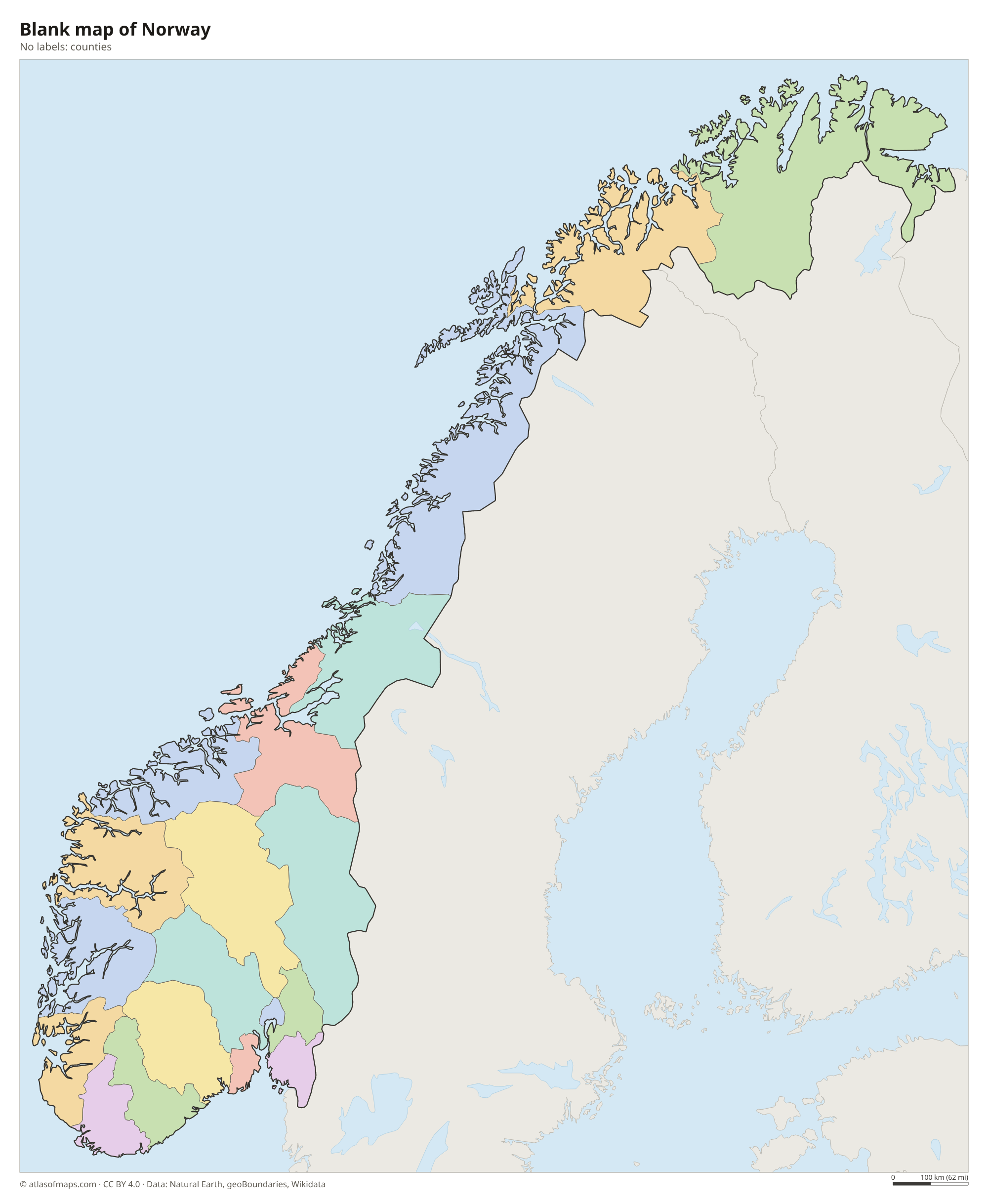
Norway is divided into counties (fylker), and the map draws them from Natural Earth data. The counties were merged in 2020 and partly split again in 2024, so the borders on the map may not match the current ones. Svalbard and Jan Mayen are outside the county system.
The divisions on the map come from Natural Earth and may not reflect the latest territorial reform in Norway.
| County | Capital | Population | Area |
|---|---|---|---|
| Akershus | Oslo | 749,207 | 5,892 km² (2,275 sq mi) |
| Aust-Agder | Arendal | 117,655 | 11,889 km² (4,590 sq mi) |
| Bouvet Island | — | — | — |
| Buskerud | Drammen | 272,981 | 15,054 km² (5,812 sq mi) |
| Finnmark | Vadsø | 75,288 | 74,294 km² (28,685 sq mi) |
| Hedmark | Hamar | 197,406 | 27,398 km² (10,578 sq mi) |
| Hordaland | Bergen | 524,495 | 22,687 km² (8,759 sq mi) |
| Møre og Romsdal | Molde | 265,392 | 14,356 km² (5,543 sq mi) |
| Nord-Trøndelag | Steinkjer | 136,399 | 22,415 km² (8,654 sq mi) |
| Nordland | Bodø | 243,385 | 38,155 km² (14,732 sq mi) |
| Oppland | Lillehammer | 189,545 | 25,192 km² (9,727 sq mi) |
| Oslo | Oslo | 717,710 | 454 km² (175 sq mi) |
| Østfold | Sarpsborg | 297,520 | 5,077 km² (1,960 sq mi) |
| Rogaland | Stavanger | 499,417 | 9,377 km² (3,620 sq mi) |
| Sogn og Fjordane | Hermansverk | 109,774 | 27,110 km² (10,467 sq mi) |
| Sør-Trøndelag | Trondheim | 318,359 | 18,839 km² (7,274 sq mi) |
| Svalbard | Longyearbyen | 2,668 | 61,022 km² (23,561 sq mi) |
| Telemark | Skien | 173,318 | 16,158 km² (6,239 sq mi) |
| Troms | Tromsø | 167,207 | 41,133 km² (15,882 sq mi) |
| Vest-Agder | Kristiansand | 187,589 | 11,084 km² (4,280 sq mi) |
| Vestfold | Tønsberg | 251,078 | 2,225 km² (859 sq mi) |
Population from Wikidata (latest figure available for each county).
Blank and coloring maps of Norway
Blank map of Norway

Coloring map of Norway

Geography of Norway
Mainland Norway is long and narrow, and with its Arctic islands the country covers 385,207 km² (148,729 sq mi). The Scandinavian Mountains run along most of its length, forming high plateaus such as Hardangervidda and ranges such as Jotunheimen, where Galdhøpiggen reaches 2,469 m (8,100 ft). Jostedalsbreen is the largest glacier in mainland Europe. The coast is cut by deep fjords carved by ice and lined with tens of thousands of islands, including the Lofoten islands.
The Sognefjord is the longest and deepest fjord in Norway. Most rivers are short and steep, with many waterfalls used for hydroelectric power, but in the east the Glomma, the longest river, flows south through broad valleys to the sea. Mjøsa is the largest lake. Far to the north lies the Arctic archipelago of Svalbard. Thanks to the warm North Atlantic Current, the coast is much milder than other places at the same latitude, while the north has midnight sun in summer and polar night in winter.
Fun facts
- The Lærdal Tunnel in western Norway, about 24.5 km (15.2 mi) long, is the longest road tunnel in the world.
- Longyearbyen, on Svalbard, is one of the northernmost towns in the world.
- In the far north, around the North Cape, the sun does not set from mid-May to late July.
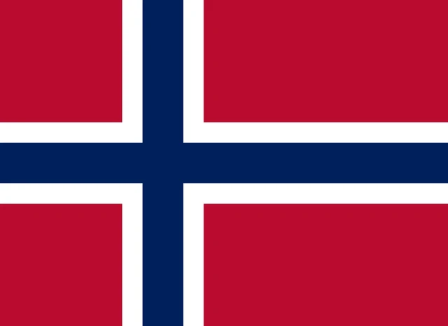
Flag of Norway
The flag of Norway is red with a dark blue Nordic cross outlined in white. The cross extends to all four edges, and its vertical bar is set closer to the hoist, as on the other Scandinavian flags. The flag has an 8:11 ratio and no emblem.
Countries bordering Norway
Frequently asked questions
What countries border Norway?
Norway borders three countries: Sweden along a long eastern border, and Finland and Russia in the far northeast. The rest of the country faces the sea.
Is Norway in the European Union?
No. Norwegian voters rejected EU membership in referendums in 1972 and 1994. Norway is part of the European Economic Area and the Schengen Area, and it uses its own currency, the Norwegian krone.
What is the capital of Norway?
Oslo is the capital and largest city. It lies at the head of the Oslofjord in the southeast of the country.
What language is spoken in Norway?
The official languages are Bokmål, Sámi, Nynorsk, and Norwegian.
Can I print the map of Norway?
Yes. Every map on this page can be downloaded for free as PNG or PDF (US Letter) and printed, including the blank map and the coloring map. Please credit the source (Atlas of Maps, CC BY 4.0).
Use this map
You can download, print and share this map for free, in class, in school projects, in presentations and on websites, as long as you credit the source: Map of Norway · Atlas of Maps (atlasofmaps.com), license CC BY 4.0.
See also: Map of Europe · World map