Map of Guyana with regions and capitals
Guyana is a country on the northern coast of South America. It borders Venezuela to the west, Brazil to the south and southwest and Suriname to the east, with the Atlantic Ocean along its northern coast. The political map shows its 10 regions, the capital, Georgetown, and major cities.

- Capital
- Georgetown
- Population
- 878,674 (2022)
- Area
- 214,970 km² (83,000 sq mi)
- Population density
- 4 per km² (11 per sq mi)
- Official language
- English
- Currency
- Guyanese dollar
- Demonym
- Guyanese
- Regions
- 10
- Highest point
- Mount Roraima (2,810 m (9,219 ft))
- Calling code
- +592
- Internet domain
- .gy
- Official name
- Co-operative Republic of Guyana
Where is Guyana?
Guyana is a country on the northern coast of South America. It borders Venezuela to the west, Brazil to the south and southwest and Suriname to the east, with the Atlantic Ocean along its northern coast.

Regions of Guyana and their capitals
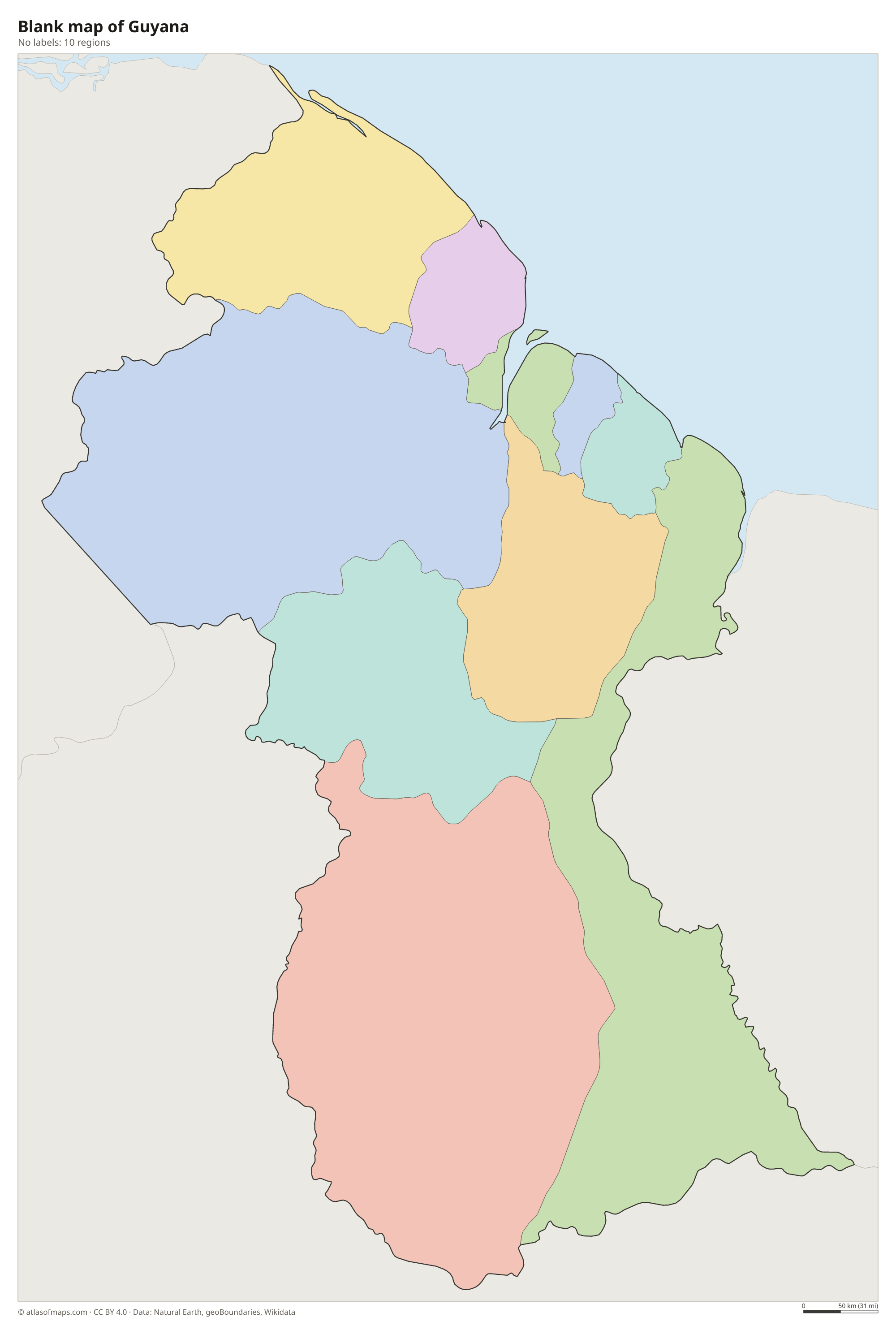
Guyana is divided into 10 regions, each named after rivers or areas and also known by a number from 1 to 10, such as Region 4, Demerara-Mahaica, which includes Georgetown. Region 9, Upper Takutu-Upper Essequibo, is the largest.
| Region | Capital | Population | Area |
|---|---|---|---|
| Barima-Waini | Mabaruma | 38,956 | 20,339 km² (7,853 sq mi) |
| Cuyuni-Mazaruni | Bartica | 30,324 | 47,213 km² (18,229 sq mi) |
| Demerara-Mahaica | Paradise | 347,759 | 2,232 km² (862 sq mi) |
| East Berbice-Corentyne | New Amsterdam | 114,574 | 36,234 km² (13,990 sq mi) |
| Essequibo Islands-West Demerara | — | 57,667 | 4,190 km² (1,618 sq mi) |
| Mahaica-Berbice | — | 57,667 | 4,190 km² (1,618 sq mi) |
| Pomeroon-Supenaam | Anna Regina | 56,469 | 6,195 km² (2,392 sq mi) |
| Potaro-Siparuni | Mahdia | 10,190 | 20,051 km² (7,742 sq mi) |
| Upper Demerara-Berbice | Linden | 45,499 | 17,040 km² (6,579 sq mi) |
| Upper Takutu-Upper Essequibo | Lethem | 29,944 | 57,750 km² (22,297 sq mi) |
Population from Wikidata (latest figure available for each region).
Blank and coloring maps of Guyana
Blank map of Guyana

Coloring map of Guyana

Geography of Guyana
Guyana covers 214,970 km² (83,000 sq mi), and dense tropical rainforest covers most of it. Along the Atlantic lies a narrow coastal plain, partly below sea level at high tide and protected by a seawall and dikes; most Guyanese live here, including in the capital, Georgetown. Inland, a belt of sandy hills gives way to the highlands of the Guiana Shield. In the west, the Pakaraima Mountains end at Mount Roraima, a flat-topped tepui where Guyana meets Brazil and Venezuela, at 2,810 m (9,219 ft). The Rupununi savanna spreads across the southwest.
Guyana's name is often explained as land of many waters. Its big rivers, the Essequibo, the Demerara, the Berbice and the Corentyne, flow north to the Atlantic, and the Corentyne forms the border with Suriname. On the Potaro River, Kaieteur Falls drops 226 m (741 ft) in a single plunge. The climate is hot and humid all year, with two rainy seasons on the coast. Venezuela claims the large region west of the Essequibo River, a long-running dispute now before the International Court of Justice; the map shows the area as part of Guyana, which administers it.
Fun facts
- Guyana is the only country in South America where English is the official language.
- Although it lies on the South American mainland, Guyana is a member of CARICOM, the Caribbean Community, whose headquarters are in Georgetown.
Flag of Guyana
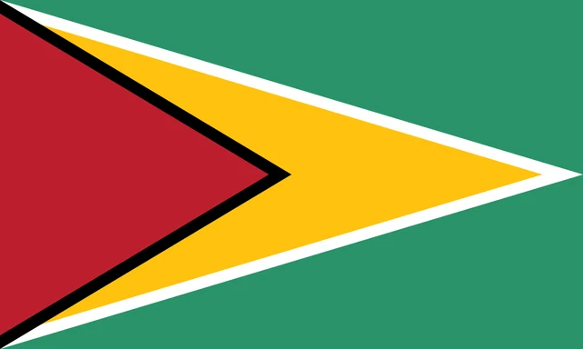
Guyana's flag, nicknamed the Golden Arrowhead, has a green field with two triangles pointing from the pole toward the fly. A large yellow triangle with a thin white border reaches the far edge, and on top of it sits a shorter red triangle with a thin black border. The flag has a 3:5 ratio.
Countries bordering Guyana
Frequently asked questions
What countries border Guyana?
Guyana borders three countries: Venezuela to the west, Brazil to the south and southwest, and Suriname to the east across the Corentyne River.
How many regions does Guyana have?
Guyana has 10 administrative regions, numbered 1 to 10. Region 4, Demerara-Mahaica, contains the capital, Georgetown, and has the most people.
Is Guyana part of the Caribbean or South America?
Geographically, Guyana is in South America. Culturally and politically it is often grouped with the Caribbean, because it is English-speaking and a member of CARICOM, the Caribbean Community.
What is the capital of Guyana?
The capital of Guyana is Georgetown.
What language is spoken in Guyana?
The official language is English.
Can I print the map of Guyana?
Yes. Every map on this page can be downloaded for free as PNG or PDF (US Letter) and printed, including the blank map and the coloring map. Please credit the source (Atlas of Maps, CC BY 4.0).
Use this map
You can download, print and share this map for free, in class, in school projects, in presentations and on websites, as long as you credit the source: Map of Guyana · Atlas of Maps (atlasofmaps.com), license CC BY 4.0.
See also: Map of South America · World map