Map of the Dominican Republic with provinces and capitals
The Dominican Republic is a Caribbean country on the island of Hispaniola, which it shares with Haiti to the west. It lies between Cuba and Puerto Rico, with the Atlantic Ocean to the north and the Caribbean Sea to the south. The political map shows its 32 provinces, the capital, Santo Domingo, and major cities.

- Capital
- Santo Domingo
- Population
- 10.8 million (2022)
- Area
- 48,671 km² (18,792 sq mi)
- Population density
- 221 per km² (573 per sq mi)
- Official language
- Spanish
- Currency
- Dominican peso
- Demonym
- Dominican
- Provinces
- 32
- Highest point
- Pico Duarte (3,101 m (10,174 ft))
- Calling code
- +1809
- Internet domain
- .do
Where is the Dominican Republic?
The Dominican Republic is a Caribbean country on the island of Hispaniola, which it shares with Haiti to the west. It lies between Cuba and Puerto Rico, with the Atlantic Ocean to the north and the Caribbean Sea to the south.
Neighboring countries: Haiti.

Provinces of the Dominican Republic and their capitals
The Dominican Republic is divided into 32 provinces, counting the National District (Distrito Nacional), which holds the historic center of Santo Domingo. The surrounding Santo Domingo province covers much of the rest of the capital's metropolitan area.
| Province | Capital | Population | Area |
|---|---|---|---|
| Azua | Azua | 236,478 | 2,683 km² (1,036 sq mi) |
| Baoruco | Neiba | 108,717 | 1,285 km² (496 sq mi) |
| Barahona | Santa Cruz de Barahona | 226,898 | 1,666 km² (643 sq mi) |
| Dajabón | Dajabón | 74,809 | 1,021 km² (394 sq mi) |
| Duarte | San Francisco de Macorís | 308,353 | 1,649 km² (637 sq mi) |
| El Seibo | Santa Cruz del Seibo | 99,168 | 1,788 km² (690 sq mi) |
| Espaillat | Moca | 233,636 | 843 km² (325 sq mi) |
| Hato Mayor | Hato Mayor del Rey | 100,134 | 1,319 km² (509 sq mi) |
| Hermanas Mirabal | Salcedo | 96,442 | 427 km² (165 sq mi) |
| Independencia | Jimaní | 60,692 | 2,007 km² (775 sq mi) |
| La Altagracia | Higüey | 446,060 | 2,998 km² (1,158 sq mi) |
| La Estrelleta | — | — | — |
| La Romana | La Romana | 287,915 | 652 km² (252 sq mi) |
| La Vega | La Vega | 442,720 | 2,292 km² (885 sq mi) |
| María Trinidad Sánchez | Nagua | 156,633 | 1,207 km² (466 sq mi) |
| Monseñor Nouel | Bonao | 195,547 | 992 km² (383 sq mi) |
| Monte Cristi | Monte Cristi | 123,519 | 1,886 km² (728 sq mi) |
| Monte Plata | Monte Plata | 205,499 | 2,602 km² (1,005 sq mi) |
| Nacional | Santo Domingo | 1,029,110 | 92 km² (36 sq mi) |
| Pedernales | Pedernales | 34,375 | 2,081 km² (803 sq mi) |
| Peravia | Baní | 209,372 | 785 km² (303 sq mi) |
| Puerto Plata | Luperon pto pta | 388,354 | 1,806 km² (697 sq mi) |
| Samaná | Samaná | 111,990 | 863 km² (333 sq mi) |
| San Cristóbal | San Cristóbal | 688,828 | 1,241 km² (479 sq mi) |
| San José de Ocoa | San José de Ocoa | 69,081 | 853 km² (329 sq mi) |
| San Juan | San Juan de la Maguana | 244,668 | 3,364 km² (1,299 sq mi) |
| San Pedro de Macorís | San Pedro de Macorís | 337,145 | 1,254 km² (484 sq mi) |
| Sánchez Ramírez | Cotuí | 162,638 | 1,186 km² (458 sq mi) |
| Santiago | Santiago de los Caballeros | 1,000,087 | 2,806 km² (1,083 sq mi) |
| Santiago Rodríguez | Sabaneta | 64,635 | 1,148 km² (443 sq mi) |
| Santo Domingo | Santo Domingo Este | 2,769,589 | 1,302 km² (503 sq mi) |
| Valverde | Mao | 183,738 | 823 km² (318 sq mi) |
Population from Wikidata (latest figure available for each province).
Blank and coloring maps of the Dominican Republic
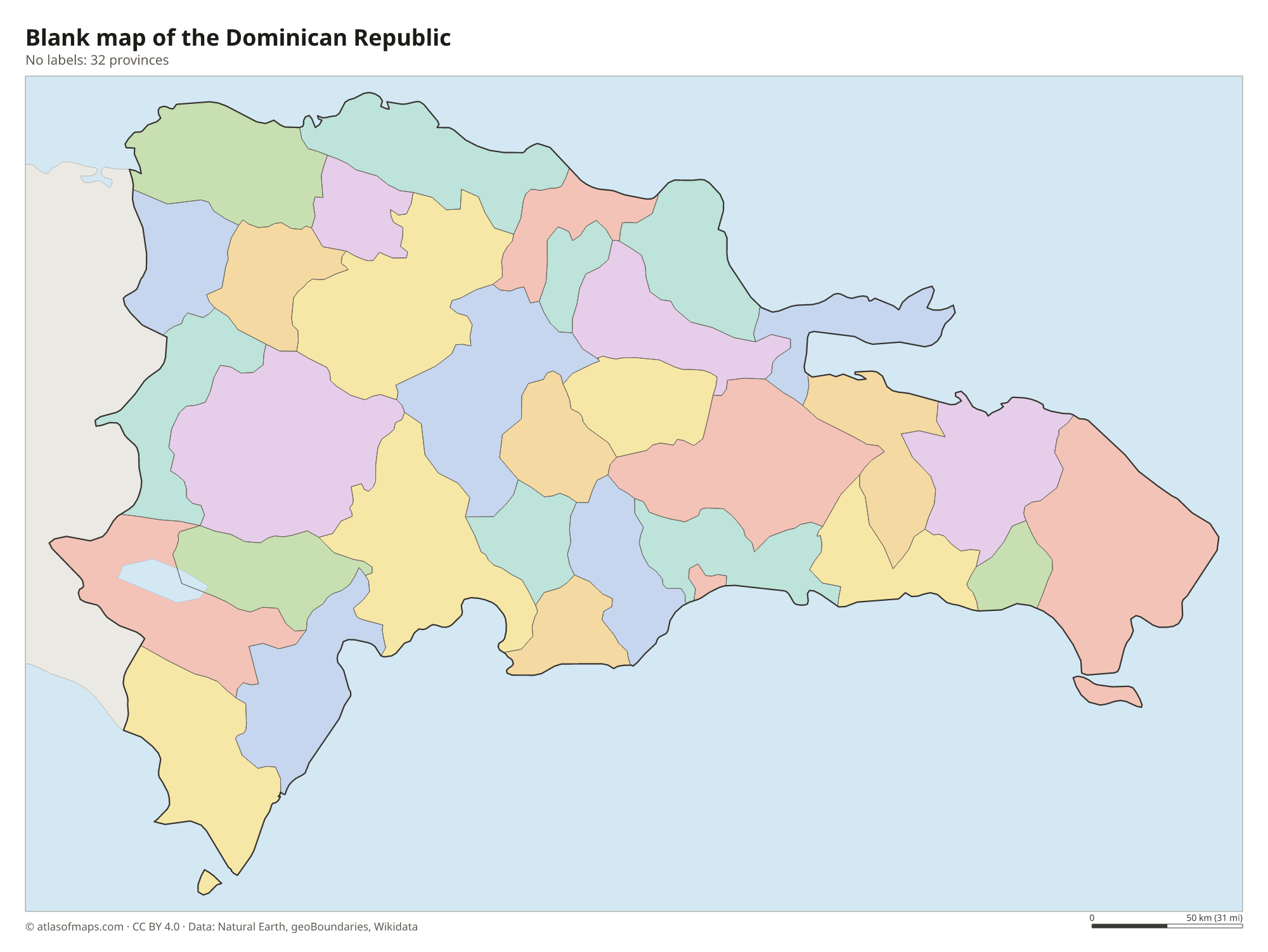
Blank map of the Dominican Republic

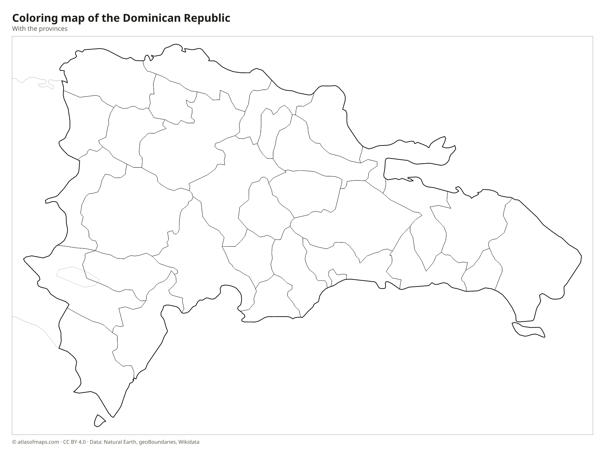
Coloring map of the Dominican Republic

Geography of the Dominican Republic
The Dominican Republic covers the eastern two-thirds of Hispaniola, an area of 48,671 km² (18,792 sq mi). Several mountain ranges cross it from northwest to southeast. The largest, the Cordillera Central, holds Pico Duarte, which at 3,101 m (10,174 ft) is the highest point in the Caribbean. North of it lies the broad Cibao Valley, the country's main farming region, bounded by the Cordillera Septentrional. In the southwest, the Sierra de Neiba and the Sierra de Baoruco enclose a deep, dry basin.
In that southwestern basin lies Lake Enriquillo, a salt lake below sea level and the lowest point in the Caribbean, home to American crocodiles and rock iguanas. The Yaque del Norte, the country's longest river, drains the Cibao toward the north coast. The east is mostly lowland plain, with sugarcane fields and long beaches around Punta Cana, and the Samaná Peninsula juts out in the northeast. The climate is tropical, and hurricanes are possible from June to November.
Fun facts
- Lake Enriquillo is the largest lake in the Caribbean and lies below sea level.
- Santo Domingo, founded in the 1490s, is the oldest continuously inhabited European settlement in the Americas.
- Thousands of humpback whales gather in Samaná Bay each winter to mate and give birth.
Flag of the Dominican Republic
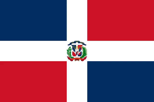
The flag of the Dominican Republic is divided by a centered white cross into four rectangles. The upper hoist and lower fly rectangles are blue, while the upper fly and lower hoist rectangles are red. In the middle of the cross is the coat of arms, which shows an open Bible, a cross and flags, framed by laurel and palm branches and the motto Dios, Patria, Libertad.
Flag of the Dominican Republic: meaning, colors and download →
Countries bordering the Dominican Republic
Frequently asked questions
What country shares an island with the Dominican Republic?
The Dominican Republic shares the island of Hispaniola with Haiti, its only land neighbor. Haiti occupies the western third of the island and the Dominican Republic the eastern two-thirds.
How many provinces does the Dominican Republic have?
The Dominican Republic has 32 provinces, counting the National District in central Santo Domingo. The largest city outside the capital area is Santiago de los Caballeros, capital of Santiago province.
What is the capital of the Dominican Republic?
The capital is Santo Domingo, on the south coast at the mouth of the Ozama River. It is the largest city in the country and one of the largest in the Caribbean.
What countries border the Dominican Republic?
The Dominican Republic shares land borders with Haiti.
What language is spoken in the Dominican Republic?
The official language is Spanish.
Can I print the map of the Dominican Republic?
Yes. Every map on this page can be downloaded for free as PNG or PDF (US Letter) and printed, including the blank map and the coloring map. Please credit the source (Atlas of Maps, CC BY 4.0).
Use this map
You can download, print and share this map for free, in class, in school projects, in presentations and on websites, as long as you credit the source: Map of the Dominican Republic · Atlas of Maps (atlasofmaps.com), license CC BY 4.0.
See also: Map of North America · Map of the Caribbean · Map of Latin America · World map