Map of Uruguay with departments and capitals
Uruguay is a small country in southeastern South America, on the Atlantic Ocean and the Río de la Plata. It borders Brazil to the north and northeast and Argentina to the west, across the Uruguay River. The political map shows its 19 departments, the capital, Montevideo, and major cities.

- Capital
- Montevideo
- Population
- 3.4 million (2023)
- Area
- 176,215 km² (68,037 sq mi)
- Population density
- 20 per km² (51 per sq mi)
- Currency
- Uruguayan peso
- Demonym
- Uruguayan
- Departments
- 19
- Highest point
- Cerro Catedral (514 m (1,686 ft))
- Calling code
- +598
- Internet domain
- .uy
- Official name
- Oriental Republic of Uruguay
Where is Uruguay?
Uruguay is a small country in southeastern South America, on the Atlantic Ocean and the Río de la Plata. It borders Brazil to the north and northeast and Argentina to the west, across the Uruguay River.

Departments of Uruguay and their capitals
Uruguay is divided into 19 departments. Montevideo, the smallest department, holds the capital and more than a third of the country's people, while Tacuarembó in the north is the largest by area.
| Department | Capital | Population | Area |
|---|---|---|---|
| Artigas | Artigas | 77,246 | 11,939 km² (4,610 sq mi) |
| Canelones | Canelones | 608,956 | 4,527 km² (1,748 sq mi) |
| Cerro Largo | Melo | 91,021 | 13,641 km² (5,267 sq mi) |
| Colonia | Colonia del Sacramento | 135,797 | 6,108 km² (2,358 sq mi) |
| Durazno | Durazno | 62,010 | 12,231 km² (4,722 sq mi) |
| Flores | Trinidad | 26,271 | 5,145 km² (1,986 sq mi) |
| Florida | Florida | 70,324 | 10,410 km² (4,019 sq mi) |
| Lavalleja | Minas | 59,175 | 10,038 km² (3,876 sq mi) |
| Maldonado | Maldonado | 212,841 | 4,800 km² (1,853 sq mi) |
| Montevideo | Montevideo | 1,302,954 | 730 km² (282 sq mi) |
| Paysandú | Paysandú | 121,838 | 13,969 km² (5,393 sq mi) |
| Río Negro | Fray Bentos | 57,338 | 9,533 km² (3,681 sq mi) |
| Rivera | Rivera | 109,300 | 9,329 km² (3,602 sq mi) |
| Rocha | Rocha | 80,710 | 10,540 km² (4,070 sq mi) |
| Salto | Salto | 136,195 | 14,012 km² (5,410 sq mi) |
| San José | San José de Mayo | 119,718 | 5,015 km² (1,936 sq mi) |
| Soriano | Mercedes | 83,684 | 8,995 km² (3,473 sq mi) |
| Tacuarembó | Tacuarembó | 96,013 | 15,973 km² (6,167 sq mi) |
| Treinta y Tres | Treinta y Tres | 47,705 | 9,291 km² (3,587 sq mi) |
Population from Wikidata (latest figure available for each department).
Blank and coloring maps of Uruguay
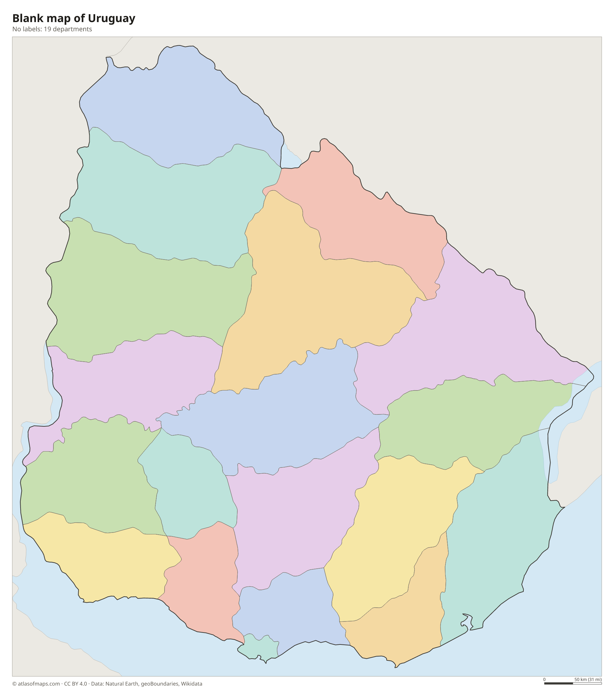
Blank map of Uruguay

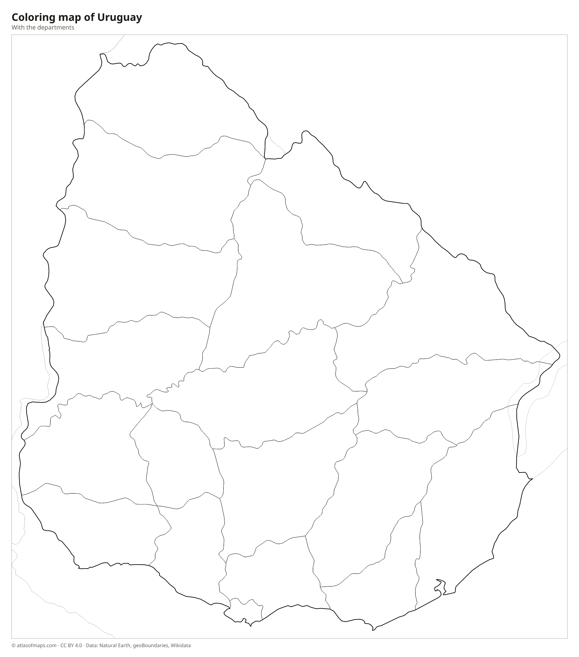
Coloring map of Uruguay

Geography of Uruguay
Uruguay covers about 176,215 km² (68,037 sq mi), which makes it the second-smallest country in South America after Suriname. It has no high mountains. Most of the land is gently rolling grassland, part of the pampas, crossed by low ridges called cuchillas, such as the Cuchilla Grande in the east and the Cuchilla de Haedo in the north. The highest point, Cerro Catedral in Maldonado, reaches only 514 m (1,686 ft). Fertile lowlands spread along the rivers in the west, where much of the country's farming is found.
Water borders Uruguay on three sides. The Uruguay River forms the western border with Argentina, the wide Río de la Plata estuary lines the south coast, and the Atlantic Ocean meets the southeast coast, with its sandy beaches and coastal lagoons. Laguna Merín (Mirim) is shared with Brazil. The Río Negro crosses the center from northeast to southwest, held back by dams that form large reservoirs. The climate is humid subtropical to temperate, with warm summers, cool winters and rain spread through the whole year.
Fun facts
- Uruguay's official name, the Oriental Republic of Uruguay, refers to its position on the eastern bank of the Uruguay River.
- Uruguay hosted and won the first FIFA World Cup in 1930.
- Montevideo and Buenos Aires face each other across the Río de la Plata, which is so wide that the opposite shore cannot be seen.
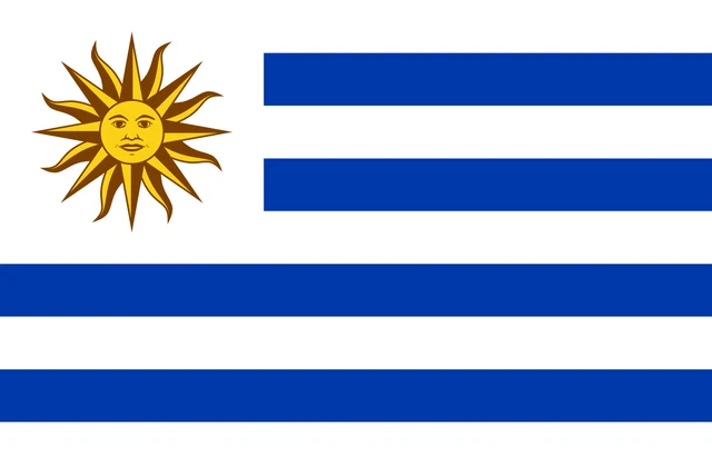
Flag of Uruguay
The flag of Uruguay has nine horizontal stripes, five white and four blue, starting and ending with white. In the upper hoist corner is a white square holding the Sun of May, a golden sun with a human face and 16 rays that alternate between straight and wavy.
Countries bordering Uruguay
Frequently asked questions
What countries border Uruguay?
Uruguay borders two countries: Brazil to the north and northeast, and Argentina to the west. The border with Argentina follows the Uruguay River and the Río de la Plata.
How many departments does Uruguay have?
Uruguay has 19 departments, from Artigas in the far north to Montevideo and Canelones on the south coast. Each department has its own elected leader, called an intendente.
What is the capital of Uruguay?
Montevideo is the capital and largest city of Uruguay. It lies on the north shore of the Río de la Plata, facing Argentina across the estuary.
Can I print the map of Uruguay?
Yes. Every map on this page can be downloaded for free as PNG or PDF (US Letter) and printed, including the blank map and the coloring map. Please credit the source (Atlas of Maps, CC BY 4.0).
Use this map
You can download, print and share this map for free, in class, in school projects, in presentations and on websites, as long as you credit the source: Map of Uruguay · Atlas of Maps (atlasofmaps.com), license CC BY 4.0.
See also: Map of South America · Map of Latin America · World map