Map of Libya with regions and capitals
Libya is a large country in North Africa on the Mediterranean Sea. It borders Egypt to the east, Sudan to the southeast, Chad and Niger to the south, and Algeria and Tunisia to the west, with a long coastline facing the Mediterranean to the north. The political map shows its 22 regions, the capital, Tripoli, and major cities.

- Capital
- Tripoli
- Population
- 7.4 million (2024)
- Area
- 1,759,541 km² (679,363 sq mi)
- Population density
- 4 per km² (11 per sq mi)
- Official language
- Arabic
- Currency
- Libyan dinar
- Demonym
- Libyan
- Regions
- 22
- Highest point
- Bikku Bitti (2,267 m (7,438 ft))
- Calling code
- +218
- Internet domain
- .ly
- Official name
- State of Libya
Where is Libya?
Libya is a large country in North Africa on the Mediterranean Sea. It borders Egypt to the east, Sudan to the southeast, Chad and Niger to the south, and Algeria and Tunisia to the west, with a long coastline facing the Mediterranean to the north.
Neighboring countries: Algeria, Egypt, Niger, Sudan, Chad, Tunisia.

Regions of Libya and their capitals
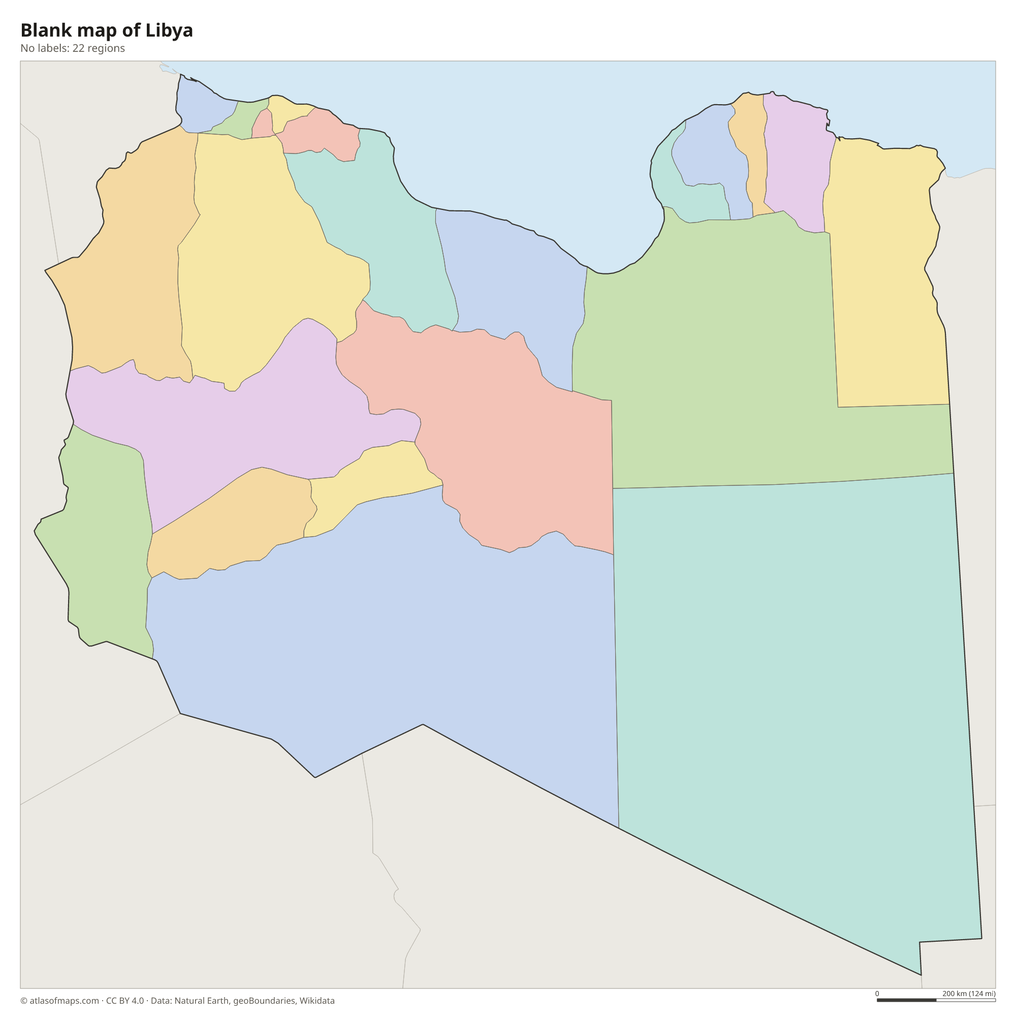
Libya is divided into 22 districts, such as Tripoli, Benghazi, Misrata and Kufra, the largest, in the southeast. They are often grouped into three historic regions: Tripolitania in the northwest, Cyrenaica in the east and Fezzan in the southwest.
| Region | Capital | Population | Area |
|---|---|---|---|
| Ajdabiya | — | — | — |
| Al Qubbah | — | — | — |
| Ash Shati | — | — | — |
| Benghazi | — | 631,555 | 314 km² (121 sq mi) |
| Butnan | Tobruk | — | — |
| Ghadames | — | — | — |
| Ghat | Ghat | — | — |
| Jabal al Akhdar | Al Bayda | — | 7,800 km² (3,012 sq mi) |
| Jafara | ‘Aziziya | — | 2,666 km² (1,029 sq mi) |
| Jufra | Hun | — | 117,410 km² (45,332 sq mi) |
| Kufra | Al Jawf | 50,104 | 483,510 km² (186,684 sq mi) |
| Marj | encampment of Al Marj | — | 10,000 km² (3,861 sq mi) |
| Misrata | البيضاء | — | — |
| Mizdah | — | — | — |
| Murqub | Al Khums | — | — |
| Murzuq | Murzuk | — | 349,790 km² (135,055 sq mi) |
| Nuqat al Khams | Zuwara | — | — |
| Sabha | Sabha | — | — |
| Sirte | Sirte | 141,378 | 77,660 km² (29,985 sq mi) |
| Tripoli District | Tripoli District | — | — |
| Wadi al Hayaa | Ubari | — | 31,890 km² (12,313 sq mi) |
| Zawiya | Zawiya | — | — |
Population from Wikidata (latest figure available for each region).
Blank and coloring maps of Libya
Blank map of Libya

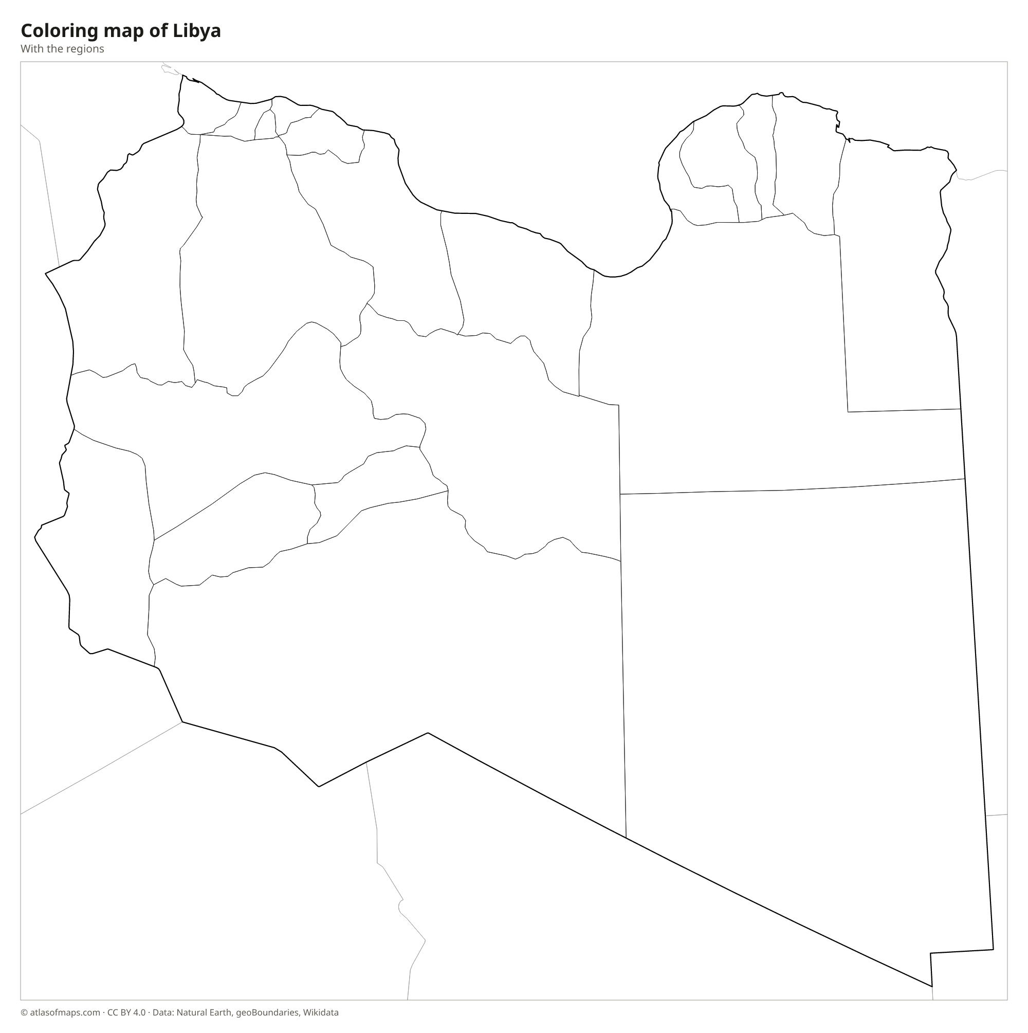
Coloring map of Libya

Geography of Libya
Libya covers 1,759,541 km² (679,363 sq mi), making it the fourth-largest country in Africa, and most of it lies in the Sahara. Huge sand seas, such as the Ubari and Calanshio, alternate with rocky plateaus and gravel plains. Only the north has notable greenery: the Jafara plain and the Nafusa Mountains near Tripoli in the west, and the Jebel Akhdar, or Green Mountain, near Benghazi in the east. In the far south, the Tibesti Mountains reach into Libya from Chad, and there Bikku Bitti is the highest point at 2,267 m (7,438 ft).
Libya has no permanent rivers. Dry riverbeds called wadis fill only after rare rains, and oases such as Kufra, Ghat and Ghadames depend on groundwater. The Great Man-Made River, a huge network of pipelines, carries ancient groundwater from aquifers under the desert to the coastal cities. The coast along the Gulf of Sidra and the Mediterranean has a Mediterranean climate with mild, wet winters, while the interior is one of the hottest and driest places on Earth. Hot desert winds called ghibli can bring sandstorms to the coast.
Fun facts
- A temperature of 58 °C (136 °F) once claimed for Al Aziziyah in Libya was rejected as a world record by the World Meteorological Organization in 2012.
- The rock paintings of Tadrart Acacus in southwestern Libya, a UNESCO World Heritage Site, show that the Sahara was once much greener.
- The ruins of Leptis Magna, east of Tripoli, are among the best-preserved Roman cities in the Mediterranean.
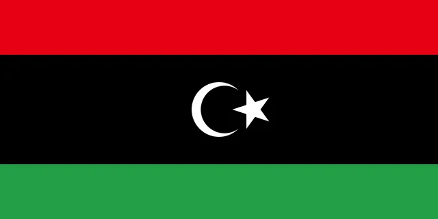
Flag of Libya
Libya's flag has three horizontal stripes: red at the top, a black stripe twice as tall in the middle and green at the bottom. In the center of the black stripe is a white crescent moon with a white five-pointed star. The flag has a 1:2 ratio.
Countries bordering Libya
Frequently asked questions
What countries border Libya?
Libya borders six countries: Egypt to the east, Sudan to the southeast, Chad and Niger to the south, Algeria to the west and Tunisia to the northwest.
How many districts does Libya have?
The map shows 22 districts. The largest is Kufra in the southeast, while the most populous districts, such as Tripoli and Benghazi, lie on the Mediterranean coast.
Is Libya mostly desert?
Yes. More than 90 percent of Libya is desert or semi-desert, part of the Sahara. Most Libyans live in a narrow strip along the Mediterranean coast, especially around Tripoli and Benghazi.
What is the capital of Libya?
The capital of Libya is Tripoli.
How many regions does Libya have?
Libya is divided into 22 regions: Ajdabiya, Al Qubbah, Ash Shati, Benghazi, Butnan, Ghadames, Ghat, Jabal al Akhdar, Jafara, Jufra, Kufra, Marj, Misrata, Mizdah, Murqub, Murzuq, Nuqat al Khams, Sabha, Sirte, Tripoli District, Wadi al Hayaa, and Zawiya.
What language is spoken in Libya?
The official language is Arabic.
Can I print the map of Libya?
Yes. Every map on this page can be downloaded for free as PNG or PDF (US Letter) and printed, including the blank map and the coloring map. Please credit the source (Atlas of Maps, CC BY 4.0).
Use this map
You can download, print and share this map for free, in class, in school projects, in presentations and on websites, as long as you credit the source: Map of Libya · Atlas of Maps (atlasofmaps.com), license CC BY 4.0.
See also: Map of Africa · World map